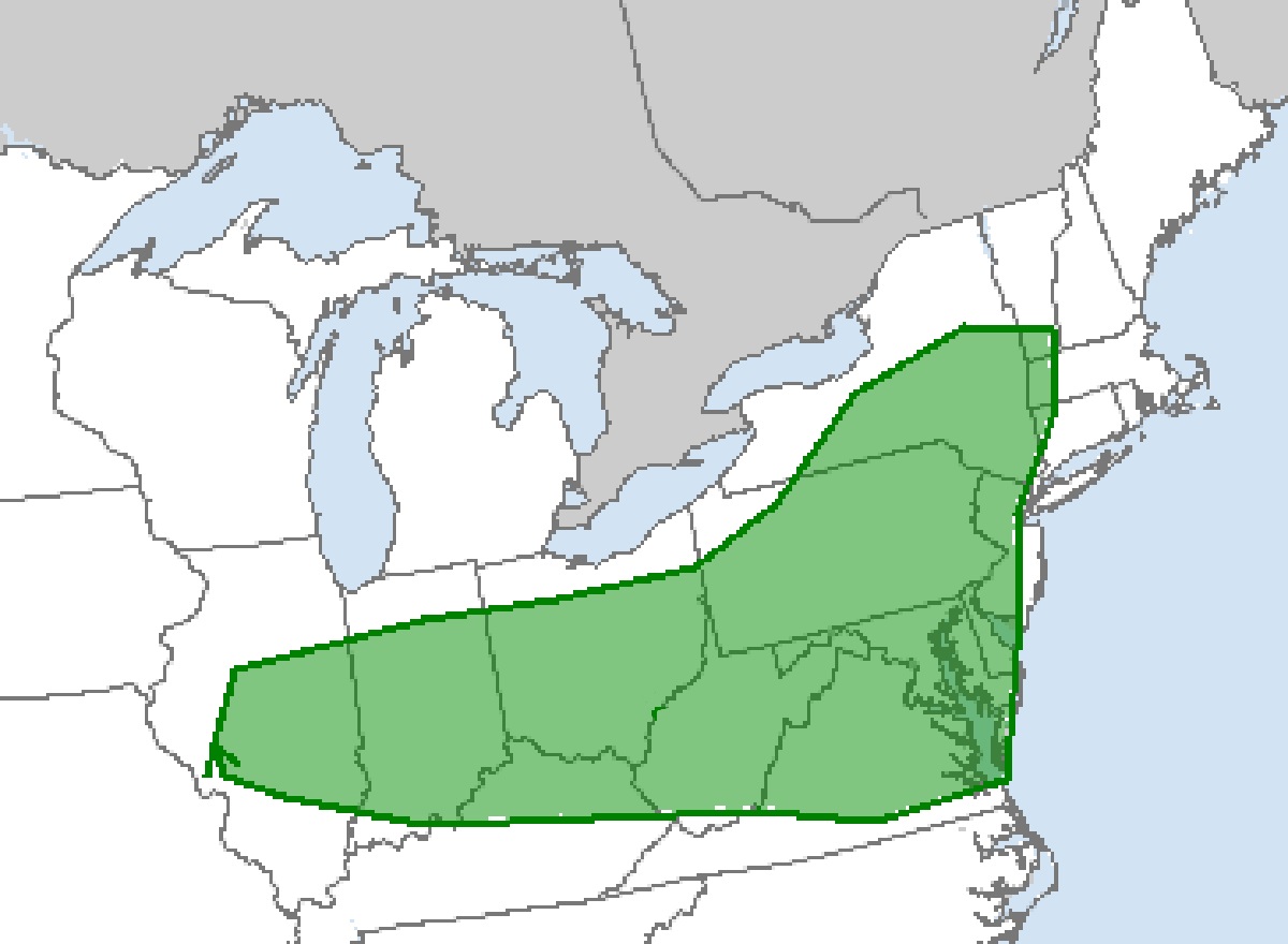
According to the latest Convective Outlook report from the National Weather Service’s Storm Prediction Center (SPC), there is an elevated threat of severe storms and tornadoes across portions of Illinois, Indiana, Ohio, West Virginia, Virginia, Pennsylvania, Maryland, Delaware, New York, Kentucky, and New Jersey. There is also an elevated tornado risk across extreme southern Vermont, far western Massachusetts, and northwestern Connecticut. In addition to the threat of severe storms, there is also a threat of soaking rains that could create flooding conditions.
According to the SPC, multiple episodes of convection are likely across a broad region extending from Illinois and Indiana eastward to portions of the Northeast and Mid-Atlantic area, as vorticity maxima rotate through the cyclonic mid-level flow field residing across the northeastern
quarter of the country. The SPC expects some early morning thunderstorm activity across both the Midwest and potentially over portions of the Mid-Atlantic region, possibly including a few stronger, possibly severe storms. As heating occurs and the atmosphere becomes more destabilized through the afternoon, additional thunderstorm action is forecast to evolve across the broader region.
The SPC says that at this time, one area of potentially greater storm coverage and severe weather potential, given the favorably strong wind field forecast to be in place over the region, will be along and east of the higher terrain of the central Appalachians. Storms should develop by early afternoon, and spread east-southeastward with time. Organized and rotating updrafts should evolve due to the available shear in the atmosphere; as such, these stronger storms will be capable of producing large hail and damaging winds.
One area with a tornado threat potential is New Jersey, which just saw a confirmed tornado on Thursday morning. Portions of the Mid Atlantic have seen an uptick in tornadic thunderstorms in the last few years, and more tornadoes are possible in tomorrow’s storm and future storm threats too.
While severe thunderstorms can contain damaging wind gusts, large hail, and isolated tornadoes, tomorrow’s storm set-up could also produce copious amounts of rain.
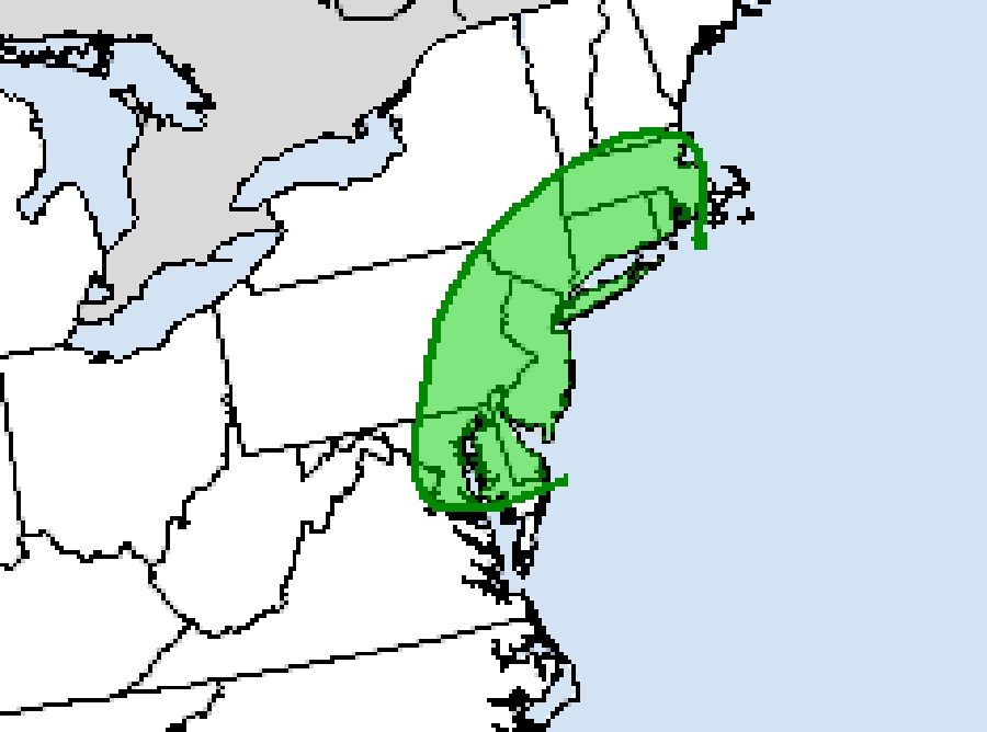
According to the National Weather Service’s Weather Prediction Center, later tomorrow into Sunday night, a mid-upper level trough will take on a negative tilt as it traverses the Mid-Atlantic and Northeastern Seaboard. Increasing broad-scale low-mid level frontogenesis along with an
uptick in low-level moisture transport will foster numerous showers and thunderstorms from the Mid Atlantic to Southern New England. These storms may produce enough heavy rain over a 1 or 3 hour period to produce flash flood conditions. The greatest threat of flash flood conditions is over Delaware, eastern Maryland and Pennsylvania, all of New Jersey, southeastern New York including all of Long Island, all of Connecticut and Rhode Island, and much of Massachusetts with the exception of Cape Cod.
The National Weather Service cautions people to “turn around, don’t drown; never drive through flood waters.”
