What was once Tropical Storm Emily which made landfall on the Florida west coast yesterday is forecast to fade away in the Atlantic, not threatening any land directly while it does so.
The fifth named storm of the 2017 Atlantic Hurricane season quickly formed yesterday, labeled “Emily” just before coming on shore near Anna Maria Island, between Tampa and Sarasota, Florida. The landfall occured at 10:45am and brought maximum sustained winds of 45mph on-shore; higher gusts were recorded in convective bands that impacted Florida around the landfall.
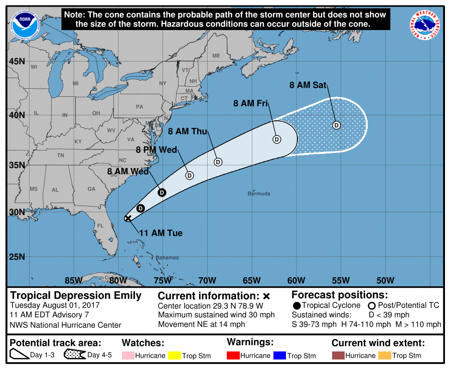
The system brought soaking rains to central and southern Florida before exiting the east coast late last night as a Tropical Depression.
After an earlier convective hiatus, recent satellite, radar, and lightning data indicate that thunderstorm activity has redeveloped within 20 nautical miles of the low-level center of Tropical Depression Emily. Because of this new convection, the National Hurricane Center (NHC) doesn’t wish to end advisories on this system yet.
According to the NHC, Emily has made the anticipated turn toward the northeast and is now moving along at 12 knots. The depression is embedded in southwesterly flow ahead of an eastward-moving, deep-layer trough and frontal system. Emily is forecast to accelerate northeastward over the western Atlantic this week and remain well offshore of the southeast and east coasts of the United States.
The National Hurricane Center says that Emily is expected to remain ahead of a cold front for the next 24 hours or so, which could allow for some slight strengthening while the southwesterly vertical wind shear remains low. Thereafter, the shear is forecast to steadily increase, resulting in Emily becoming an extratropical or post-tropical remnant low in about 36-48 hours.
Experts believe this Atlantic Hurricane Season, which runs through to the end of November, will be a busy one. Dr. Phil Klotzbach and the experts at Colorado State University updated their seasonal outlook again on July 5, showing a much more active than normal season expected. The National Oceanic and Atmospheric Administration (NOAA) also released their own forecast which shows this hurricane season to be likely more active than others.
