High winds and low relative humidity are producing critical to extremely critical fire weather in southern California, with epic fires blazing through the region on 100 mph winds. Unfortunately the fire weather is expected to continue through Thursday, threatening the homes for tens of thousands of people around Pasadena, Malibu, Pacific Palisades, and Santa Monica. Los Angeles has declared an emergency and more than 30,000 people have been ordered to evacuate their communities.
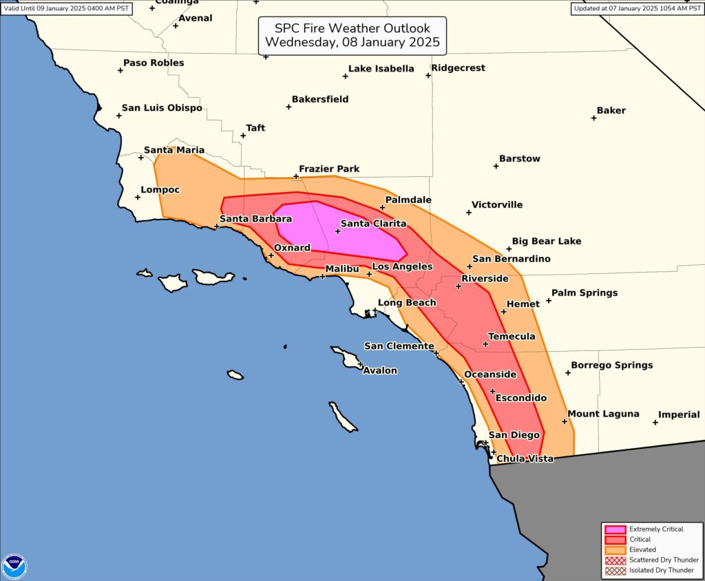
Strong high pressure will settle across the Great Basin and set the stage for the development of very strong Santa Ana winds over Southern California through Thursday. The combination of very strong downslope winds, low relative humidity, and dry fuels will result in a significant risk of critical fire weather ; in fact, the Storm Prediction Center has outlined an extremely critical risk of fire weather for portions of the LA metro area highlighting the potential for extreme fire weather behavior should ignitions occur. This atmospheric set-up has led to damaging wind gusts of 50 to 80 mph with isolated gusts of 80 to 100 mph in the mountains and foothills. These winds have the potential to cause downed trees and power lines which could lead to widespread power outages.
This is a particularly dangerous situation with fires burning out of control in heavily populated areas around Los Angeles: https://t.co/64yEqvVEes
— the Weatherboy (@theWeatherboy) January 8, 2025
The combination of low fuel moisture, low relative humidity, and gusty winds may contribute to the enhanced spread of fires in the Red Flag Warning zones. A Red Flag Warning means that critical fire weather conditions are either occurring now or will shortly due to a combination strong winds, low relative humidity, and dry fuels. Any fires that develop may quickly get out of control and become difficult to contain. Because of that threat, those in Red Flag Warning areas are encouraged to follow fire safety advice from local officials; this may mean no outdoor campfires, BBQs, or even smoking.
For more more information about wildfire danger, burn restrictions, and wildfire prevention and education, the National Weather Service encourages residents to visit their state forestry or environmental protection websites. Those in evacuation zones are urged to immediately head to safer areas away from the fire threat.
