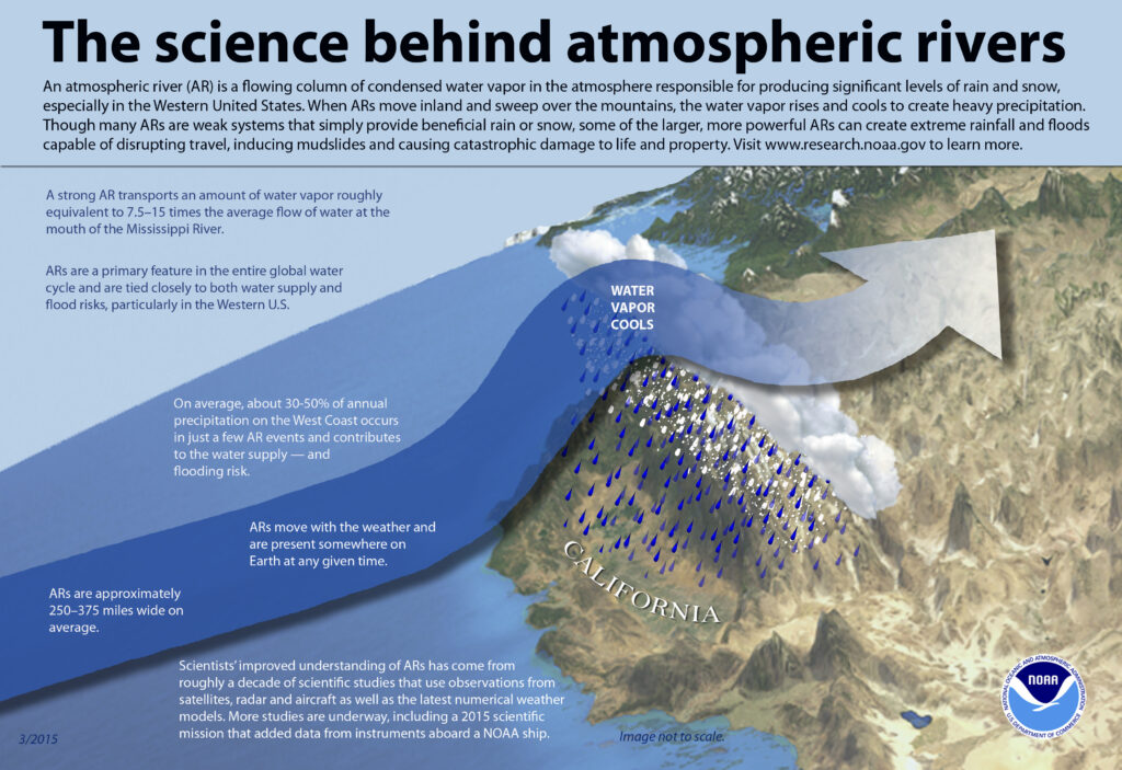
California has seen an incredible parade of significant storms in recent weeks and an even more potent storm is expected to strike today. Epic rain measured in feet and snow measured in yards is expected in portions of California as the next in a series of Atmospheric River events slam into the U.S. West Coast.
The strongest storm of the series will bring yet another round of heavy rain on already flooded rivers and saturated soils, high winds that may topple trees and power lines, and heavy snow on top of an enormous snowpack. Mudslides, flooding, rapid rises on rivers, and flash flood and debris flows on burn scars; and avalanches and infrastructure impacts become even more likely with this storm.
On Sunday evening, California Governor Gavin Newsom warned, “This is serious -stay safe, make the necessary preparations, and limit non-essential travel.”
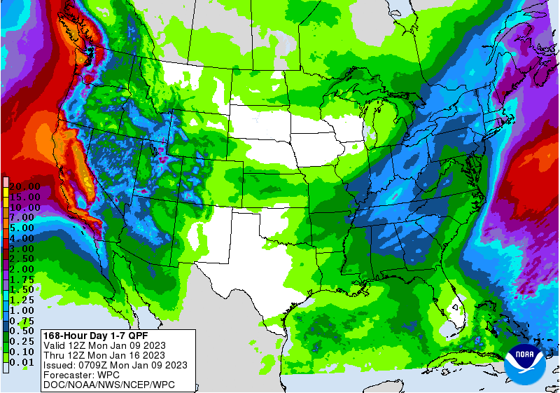
Heavy rain is expected to add up to several inches across much of central California through Tuesday. The cumulative effect of successive heavy rainfall events
will lead to additional instances of flooding. And even more rain is expected throughout the week, with 12-17″ of rain possible along the coastal ranges with 10-15 feet of snow likely in the Sierra. All of this epic precipitation will lead to rapid water rises, mudslides, and the potential for major river flooding.

The National Weather Service has issued a Moderate Risk Level (level 3/4) of Excessive Rainfall for most of central California on Monday, extending southward towards the Transverse Ranges of southern California as well.
As moisture continues to sink southward on Monday night and another push of rainfall enters on Tuesday, flash flooding is increasing likely over the southern California coastal ranges through early this week. Susceptible terrain and areas near recent burn scars will be most at risk for debris flows and rapid runoff. For the higher terrain of the Sierra Nevada, extremely heavy snow and intense snowfall rates are anticipated to make travel very dangerous to impossible at times, including the potential for road closures.
With yards of additional snow expected in the coming days, this amount of additional accumulating snow on top of an already well built snowpack is likely to increase the threat of avalanches and strain infrastructure. People are warned not to travel through severe winter storm weather conditions and to avoid all avalanche-warned areas.
Gusty winds are also expected to spread onshore with the approaching system and could lead to the threat of downed trees and power outrages. The combination of saturated soil and gusty winds could exacerbate the tree damage threat. Residents and visitors across this region are advised by the National Weather Service to check their local forecast, never drive across flooded roadways, and have both an emergency kit and evacuation plan in place.