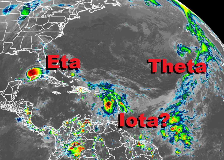
The National Hurricane Center is issuing advisories now for Eta in the Gulf of Mexico and Theta in the Atlantic; it could be issuing advisories for Iota too in the coming days.
The closest storm of concern is Eta. Eta is a tropical storm located about 90 miles north of the western tip of Cuba. Maximum sustained winds are 60 mph and the system is moving north at 7 mph.
Ahead of Eta, a Tropical Storm Warning is in effect for the Dry Tortugas while a Tropical Storm Watch is in effect for portions of Florida from Englewood to the Suwannee River. A Tropical Storm Warning means that tropical storm conditions are expected somewhere within the warning area within 36 hours. A Tropical Storm Watch means that tropical storm conditions are possible within the watch area, generally within 48 hours.
While Eta is moving to the north day, a motion toward the north or north-northeast is forecast through Wednesday night, followed by a turn toward the northeast on Thursday. On the forecast track the center of Eta will move parallel to, but offshore, of the Florida west coast on Thursday and move near or over Apalachee Bay Thursday night and Friday.
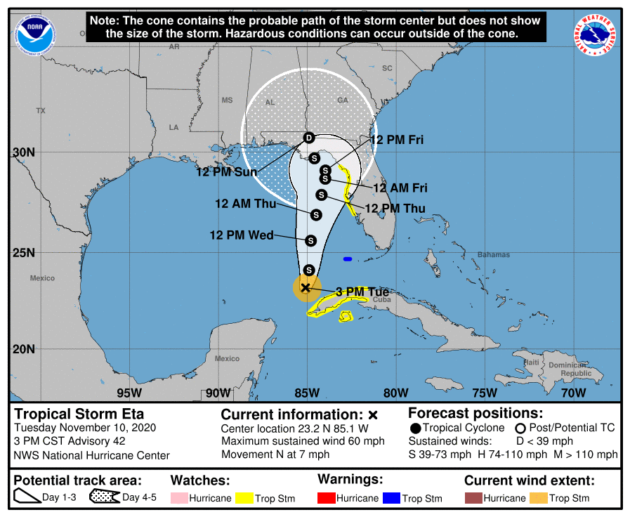
Some strengthening is forecast through Thursday morning, and Eta could be near hurricane strength by Wednesday night or Thursday morning. Gradual weakening is expected to begin Thursday afternoon or evening.
Eta will produce isolated additional rainfall amounts of 1-2″ across south Florida with isolated maximum storm totals of 15-20″ possible. Portions of West Florida and the Sun Coast, including the Tampa Bay area, will see 1-2″ with isolated totals of 4″. Additional flash and urban flooding will be possible in South Florida, especially across previously inundated areas, and eventually along portions of West Florida and the Sun Coast.
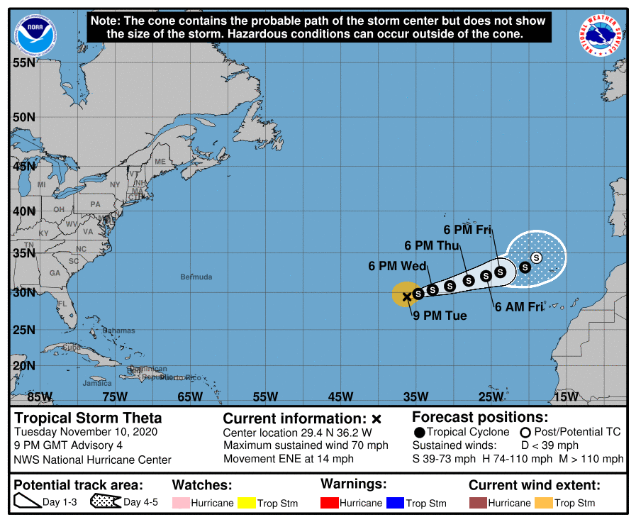
Meanwhile, Tropical Storm Theta is spinning about in the open waters of the Atlantic Ocean. It is not expected to impact any land mass over the next 72 hours.
An area yet to be named is the third area of concern that the National Hurricane Center in Miami, Florida is tracking. A tropical wave located over the eastern Caribbean Sea is producing disorganized showers and thunderstorms. According to the National Hurricane Center, this wave is expected to move westward into more conducive environmental conditions over the next several days, and a tropical depression is likely to form late this week or this weekend when the wave reaches the central or western Caribbean Sea. Beyond then, current computer forecast guidance suggests the system could become a tropical storm or hurricane as it approaches the Central American coast, an area hit hard by Eta just days ago. Right now, the National Hurricane Center says there’s a high 70% chance that a tropical cyclone will form here in the next 5 days. Should it become a tropical storm, it would be named Iota, the 9th letter of the Greek alphabet.
