Eta is heading deeper into the Gulf of Mexico for now, but it is expected to turn around and slam back into Florida later this week. And while Eta impacts Florida, meteorologists at the National Hurricane Center (NHC) in Miami, Florida are tracking two disturbances in the Atlantic that could become tropical cyclones with time. In fact, one is expected to become one soon.
There are no Tropical Storm or Hurricane Watches or Warnings of any kind for Florida for now, but that could change in the coming days as Eta makes a return to the Sunshine State.

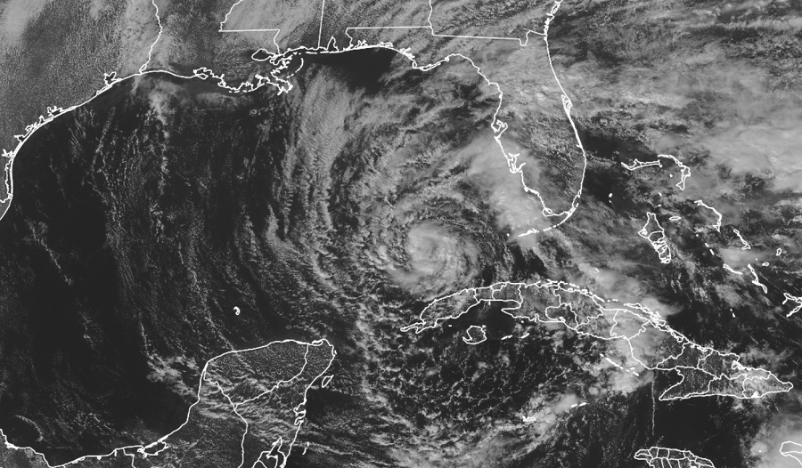
Right now with maximum sustained winds of 50 mph and a minimum central pressure of 995 mb or 29.38 inches, Eta is roughly 135 miles west-southwest of the Dry Tortugas and about 160 miles north of the western tip of Cuba. It is moving away from Florida for now, heading southwest at 16 mph.
According to the NHC, Eta will make its gradual return to Florida over the next several days. Eta is forecast to slow down tonight with little motion expected at all tomorrow. On Wednesday, a slow northward motion is expected. On Thursday, the system is expected to drift to the north and east towards the Florida panhandle, with landfall likely by Saturday morning.
Eta will evolve its strength over the next few days. While it weakened earlier today, little change in strength is expected today and tonight, according to the NHC. Some slight strengthening is forecast on Tuesday into Wednesday, followed by gradual weakening thereafter. Eta should make landfall in Florida as a tropical storm.
While the storm is in the Gulf, more soaking rains will pour on Florida. Portions of the central and southern Florida peninsula, including the Keys, will see an additional 2-4″ of rain over the next 24 hours, with isolated maximum storm totals of 18 inches in South Florida. Because of this, life-threatening flash flooding will be possible across saturated urban areas of southeast Florida. Flash and urban flooding will also be possible for the Bahamas and the remainder of southern and eastern Florida over the next several days. Minor river flooding is also possible for central Florida.
Gusty conditions will continue across the Florida Keys, south and central Florida, and the northwestern Bahamas today. Some tornadoes and waterspouts are also possible today over parts of south Florida and the Keys.
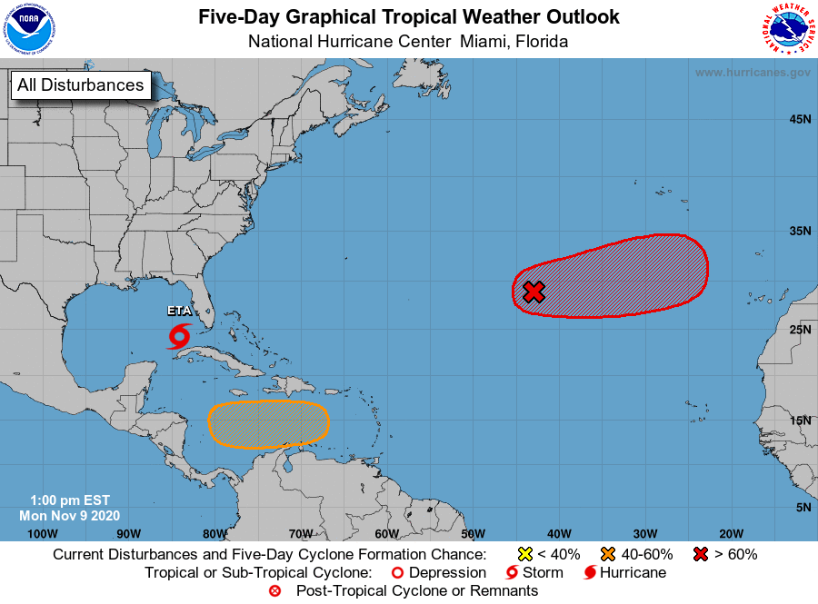
While Eta will continue to evolve in the Gulf of Mexico, the NHC is monitoring two areas in the Atlantic that could become tropical cyclones in the coming days. If they become named, the NHC would use Greek letters from the alphabet, with the next two being Theta and Iota. There has never been this many named storms in the Atlantic basin on record.

The first system is in the far Atlantic and is likely to become a tropical or subtropical cyclone in the next 2-3 days. According to the NHC, shower and thunderstorm activity associated with a low pressure system located several hundred miles southwest of the Azores has increased and become better organized during the past several hours. Satellite-derived wind data earlier this morning suggested that the system had not yet become distinct from a frontal boundary in the area; however, it will likely become non-frontal soon. The satellite data also indicated that the system is already producing gale-force winds. According to the NHC, additional development is expected, and a tropical or subtropical storm will likely form during the next day or two while the system moves eastward or east-northeastward over the
northeastern Atlantic Ocean. Right now there’s a 70% chance of formation over the next 48 hours and 80% over the next five days.
The second possible system could form in the Caribbean. A tropical wave is forecast to move over the central Caribbean Sea, where an area of low pressure could form in a couple of days. According to the NHC, environmental conditions are forecast to be conducive for development, and a tropical depression could form late this week or over the weekend while the system moves slowly westward. The NHC says there’s a 50-50 chance that the tropical depression will form over the next 5 days.
