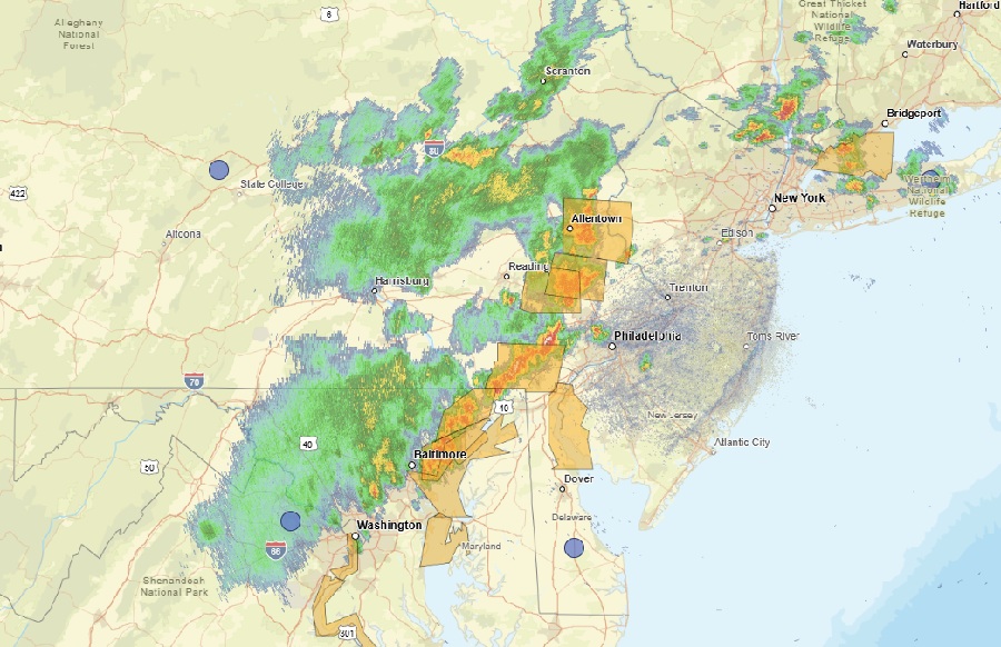
Scattered severe to damaging winds and isolated hail will be possible with thunderstorms from the central Appalachians into the Mid-Atlantic and southern New England this afternoon and evening. Due to that threat, a Severe Thunderstorm Watch has been issued with many areas now under a Severe Thunderstorm Warning with severe storms marching through portions of Pennsylvania, New Jersey, and New York now.
A broad upper ridge is present today over the southeastern U.S., with the southern fringe of stronger westerlies extending from the Ohio Valley into the Mid-Atlantic region. Earlier sunshine caused strong heating near the I-95 corridor, setting the stage for an atmosphere ripe for storm development. Scattered thunderstorm development is expected, with steep low-level lapse rates and sufficient westerly flow above the boundary-layer supporting a risk of damaging wind gusts and some hail in the strongest storms.
While damaging winds are possible, these storms will also bring some relief: the hot and humid conditions with record setting early season heat will end by this evening. But before the break in the heat arrives, some will need to deal with the severe storms.
According to the National Weather Service, some clustering may tend to occur with some guidance also hinting at some bowing segments. The primary severe weather threat from thunderstorms should be damaging downburst winds; forecast data also shows that cloud tops could extend upwards of 40,000 feet therefore some hail is possible. General rainfall totals are 0.10-0.50 inches, however given precipitable water values of 1.5-2.0 inches, localized higher amounts are likely with any stronger showers or thunderstorms which could create isolated flash flood concerns.
Once the storms clear the coast, it will turn noticeably cooler tonight as the winds becoming northerly.
