Eta lashed Central America yesterday as a major category 4 hurricane, bringing a storm surge measured in yards and rainfall measured in feet. Flooding rains and mudslides continue there today, but now it looks like the United States will be impacted by this storm too in the coming days, with a possible collision course with Florida in the works.
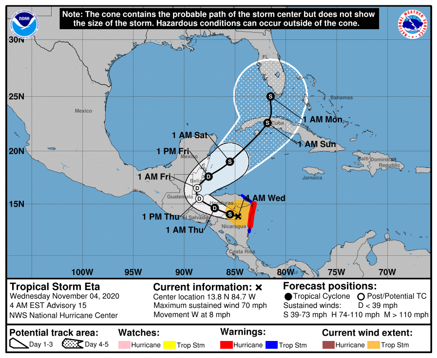
Eta has weakened to a strong tropical storm now, packing maximum sustained winds of 70 mph. It is currently moving west through Central America at 8 mph with a minimum central pressure of 990 mb or 29.24 inches.
The National Hurricane Center (NHC) in Miami, Florida is forecasting for the storm to curve around and head north, possibly impacting Florida as early as late Sunday night. The NHC says a faster west-northwestward motion is expected through Thursday morning; that should be followed by turn toward the north, and then a northeast motion is forecast Thursday night and Friday. On the forecast track, the center of Eta is expected to move over northern Nicaragua through this morning, and then move across the central portions of Honduras through Thursday morning. The system is forecast to emerge over the northwestern Caribbean Sea on Friday. On Saturday, it is forecast to approach Cuba from the south; on Sunday, it should continue moving north to Florida. On Monday, Eta could be impacting south Florida directly.
As Eta continues to move over land today, continued weakening will occur. The NHC expects Eta will weaken to a
tropical depression by tonight. However, as the system heads back over water, additional strengthening is expected. By late Friday or early Saturday, Eta should be a tropical storm once again. It is too soon to tell what intensity the storm will be when/if it impacts Florida or the U.S. coast.
