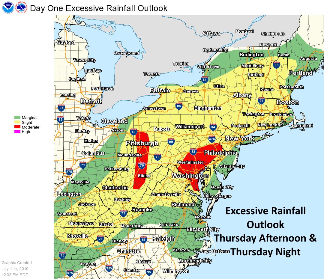
A potent weather system will bring excessive rain and severe thunderstorms to portions of the Mid Atlantic and Northeast this afternoon and evening, prompting the National Weather Service to issue Flood Watches for a large area. The threat is increasing across parts of the Mid Atlantic region for thunderstorms with extremely heavy rain producing flash flooding this afternoon and tonight, especially along the I-95 corridor from northern New Jersey to Washington, DC & the I-81 corridor from Harrisburg, Pennsylvania to Roanoke, Virginia.
Multiple hazards remain in the forecast today and tonight as several rounds of showers and thunderstorms will increase in coverage through the day, especially this afternoon. A warm front that entered this region this morning will slowly lift north, being replaced by a lee-side/pre-frontal trough developing to the west near the Great Lakes. This will advance eastward ahead of the actual cold front that will not arrive at the coast until later tonight. This front will trigger activity that will produce severe weather and flooding rain potential for this afternoon and this evening. Instability will build across eastern pennsylvania, Delaware, eastern Maryland, as well as New Jersey as well. With instability, there’s a risk of severe thunderstorms which could have damaging wind gusts or even produce an isolated tornado or two.
The main concern for today and tonight remains the potential for heavy rainfall with the showers and thunderstorms . Precipitable water will increase to 2.0-2.25 inches by this afternoon before the heavy rain begins. As a short wave approaches, it will enhance shower and thunderstorm activity, and this very moist airmass will allow for very efficient rain producing storms. Computer forecast guidance continues to show the potential for some storms to produce up to 2-4 inches of rainfall, with a wider area of 1-2 inches. Flooding is likely, especially in eastern Pennsylvania, Maryland, and Virginia, including the Washington, DC metro area that saw record flooding just days ago.
The National Weather Service urges people to “turn around, don’t drown” and to never drive across flood waters.
