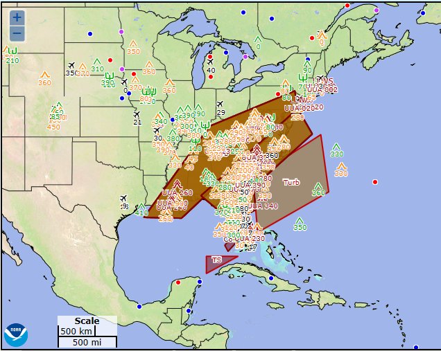
The National Weather Service’s Aviation Weather Center is warning air travelers in a large part of the southeastern United States to buckle up. There have been numerous severe turbulence reports in from aviators and the National Weather Service has issued at least three SIGMETs today.
A SIGMET advises of weather, other than convective activity, that is potentially hazardous to all aircraft. SIGMETs are typically issued for the continental United States and adjacent coastal waters for severe icing, severe or extreme turbulence, dust storms and/or sand storms lowering visibility to below 3 miles, or volcanic ash. These SIGMET items are considered to be widespread because they must be affecting or be forecast to affect an area of at least 3000 square miles at any one time. However, if the total area to be affected during the forecast period is very large, it could be that only a small portion of this total area would be affected at any one time. SIGMETs are issued for 6 hour periods for conditions associated with hurricanes and 4 hours for all other events. If conditions persist beyond the forecast period, the SIGMET is updated and reissued. Convective SIGMETs are issued hourly for thunderstorm-related aviation hazards.
Pilots have been reporting “severe turbulence” between 25,000 and 39,000 feet, which is prime travel airspace for commercial flights. The reason for the extreme turbulence is the vicinity and veracity of the jet stream in this part of the country.
Flights impacted by the exceptionally rough air include flights to/from New York area airports and Florida, service from American Airline’s hubs in Charlotte and Philadelphia, Delta Airline’s hub in Atlanta, and United Airline’s hubs in Newark and Washington, DC. The rough weather is expected to last into the night.