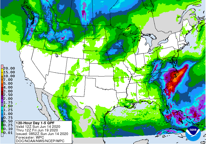
A threat of flooding in the Mid Atlantic is coming better into focus, with the National Weather Service’s Weather Prediction Center able to better define where the flood threat will exist this week.
The weather pattern this week will allow for a soggy situation to linger for many days. Right now, it appears the Carolina coastline will be the bullseye for the heaviest precipitation, with 3-6″ or more expected over the next 4 days over eastern North and South Carolina. Portions of the Outer Banks of North Carolina could see amounts approach or exceed 7″.
With the focus on the Carolinas, much of the northeast should remain dry. While some showers are expected as far north as eastern Pennsylvania, New Jersey, and the New York City metro area, the flooding rain threat should remain south of Delaware.
In the southeast, conditions will be wet too, with south Florida likely to see 1-2″ of rain over the next 3-5 days. Recent rains from Tropical Storm Cristobal and other non-tropical systems have soaked much of Florida, putting an end to the drought that was there just weeks ago.
In areas where heavy rain is expected, people should be on alert for flood hazards. People at risk from flooding in low-lying areas should consider taking steps to protect life and property. The National Weather Service also warns drivers: “turn around, don’t drown; never drive through flood waters.”