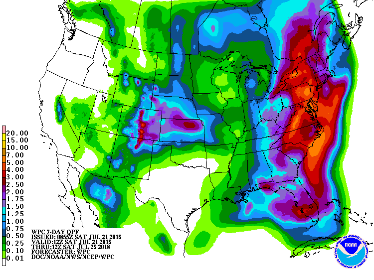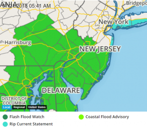
An unusual weather pattern, kicking off with today’s coastal storm, will set the stage for a prolonged period of soaking rains across a large part of the eastern United States. In their latest rainfall forecast, the National Weather Service’s Weather Prediction Center (WPC) is calling for 5-10″ of rain along a large part of the East Coast for the next 7 days including today. A coastal storm will bring the first round of heavy rain up the coast today, with the heaviest rain expected over portions of Maryland, Delaware, New Jersey, and Pennsylvania. This has prompted the National Weather Service to issue a Flash Flood Watch for the area. Many more flood advisories are likely throughout the eastern U.S. as a soggy pattern takes hold.

According to the WPC, many variables will conspire together to create the flooding set-up. Deep moisture with pooled precipitable water values upwards of 2″ feeding into and ahead of an east coast system will set the stage for heavy rainfall. The associated, slow moving surface fronts and resulting instability will fuel a prolonged pattern favorable for repeat activity that will lead to a threat of locally heavy/excessive rainfall centering up across the Appalachians and Eastern Seaboard. This lead system will be eventually replaced by a well defined upstream trough working across the Great Lakes and northeastern states Wednesday into next weekend, which will bring another round of heavy rain into next weekend.
With all of this wet weather, the National Weather Service warns that there will be numerous flood problems. Flash flooding and longer term/larger scale flooding, such as river flooding, will be possible as this wet weather pattern takes hold.
The National Weather Service warns people of their flooding slogan: “Turn around, don’t drown; never drive through flood waters.”