A weak weather system with limited moisture to work with may drop just enough snow to make conditions slick in portions of the northeast tomorrow. Motorists are reminded that even a little bit of light snow could make for big headaches on untreated roadways.
The weak weather system responsible for the light snow is a fast-mover. A mid level short wave which was located over Manitoba this morning is diving southeastward; it should pass over the northeastern states on Wednesday afternoon and evening. Clouds and light precipitation are expected in the lift ahead of the arriving short wave.
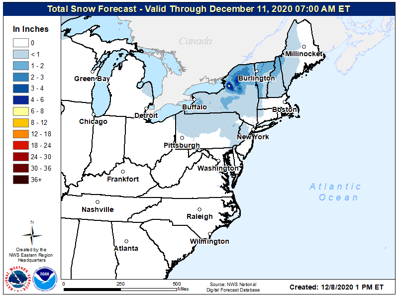
As the disturbance dips through the northeast, light snow showers are expected as far south as the I-95 corridor on Wednesday morning, where the snow could mix with a little rain before ending. On the southern fringe of this weather system, precipitation amounts will be light with many areas not seeing more than a dusting of snow. In the higher elevations of the Poconos and northwestern New Jersey, up to an inch or two of snow could accumulate. In Upstate New York, where lake effect snow will enhance the snow from this system, several inches could fall, with widespread 2-4″ and isolated 6-8″ amounts possible there. 1.5-2.5″ of snow are also possible over northern and western Vermont and northern New Hampshire where a colder, drier air mass could yield somewhat greater snowfall amounts.
Southwest to west winds will be relatively light on Wednesday, gusting up to only 10-15 mph. After rising into the 30s and low 40s in the northeast and northern Mid Atlantic areas, temperatures will fall back below freezing Wednesday night. Any untreated surface that remains wet from the light precipitation earlier in the day could become slick and icy.
High pressure will build in from the Mississippi River Valley on Wednesday night to the East Coast on Thursday night. This new air mass will likely bring a return of dry conditions and seasonable temperatures through to the end of the week.
