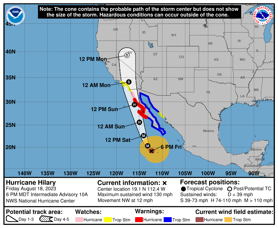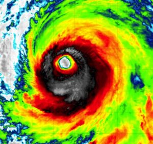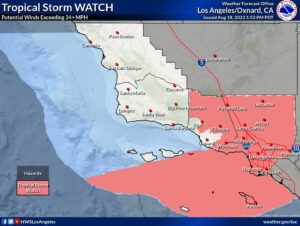
For the first time ever, the National Hurricane Center (NHC) in Miami, Florida has issued Tropical Storm Watches for most of southern California, including Los Angeles and San Diego and all points in between. People throughout this region are being urged to prepare for Hilary, currently a powerful category 3 hurricane located off the coast of Mexico. Based on the latest forecast, the core of Hilary is expected to be very near the central portion of Baja California Saturday night and move inland over southern California by Sunday night. While the storm will weaken over time, strong winds and heavy rains will impact California and such impacts will occur well ahead of the storm center’s arrival.

Numerous watches and warnings are in effect in the United States and Mexico. A Hurricane Warning is in effect for the Baja California peninsula from Punta Abreojos to Cabo San Quintin while a Hurricane Watch is in effect for Baja California peninsula north of Cabo San Quintin to Ensenada. A Hurricane Warning means that hurricane conditions are expected somewhere within the warning area. A warning is typically issue 36 hours before the anticipated first occurrence of tropical-storm-force winds, conditions that make outside preparations difficult or dangerous. A Hurricane Watch means that hurricane conditions are possible within the watch area. A watch is typically issued 48 hours before the anticipated first occurrence of tropical-storm-force winds, conditions that make outside preparations difficult or dangerous. A Tropical Storm Warning is also in effect for Baja California peninsula from Punta Abreojos southward, Baja California peninsula entire east coast, and Mainland Mexico north of Guaymas. A Tropical Storm Watch is in effect for Mainland Mexico from Huatabampito to Guaymas, Baja California north of Ensenada to the California/Mexico border, California/Mexico border to Point Mugu, and all of Catalina Island. A Tropical Storm Warning means that tropical storm conditions are expected somewhere within the warning area within 36 hours. A Tropical Storm Watch means that tropical storm conditions are possible within the watch area, generally within 48 hours.
As of the latest advisory from the NHC, Hilary was 310 miles south-southwest of Cabo San Lucas, Mexico and was moving north at 12 mph. Winds are up to 130 mph making it a powerful category 4 hurricane on the Saffir-Simpson hurricane wind scale. The storm is moving northwest at 12 mph. The estimated minimum central pressure is down to 948 mb or 28.00″.
The National Hurricane Center expects Hilary to turn toward the north-northwest tonight, followed by a faster motion toward the north Saturday night and Sunday. On the forecast track, the center of Hilary will move close to the west coast of the Baja California peninsula over the weekend and reach southern California by Sunday night. As the storm heads north closer to the United States, it is expected to weaken, however, it is expected to remain a tropical storm when it impacts California Sunday night. This will be the first time since 1939 a tropical storm has hit California and only the second time it’s ever happened on record.
Yes, excessive rainfall and epic floods possible in southern California from #Hilary! #CAwx https://t.co/DteYUKf7fs
— the Weatherboy (@theWeatherboy) August 18, 2023

Hilary is forecast to bring epic rains and significant floods to portions of Mexico and the southwestern United States over the coming days. Hilary is expected to produce rainfall amounts of 3-6″ with isolated amounts up to 10″ possible across portions of the Baja California Peninsula through Sunday night. Flash and urban flooding, locally catastrophic, will be possible, especially in the northern portions of the peninsula. Heavy rainfall in association with Hilary is expected to impact the Southwestern United States through next Wednesday, peaking on Sunday and Monday. Rainfall amounts of 3-6″, with isolated amounts as high as 10″, are expected across portions of southern California and southern Nevada. Dangerous to locally catastrophic flooding will be possible. Elsewhere across portions of the Western United States, rainfall totals of 1-3″ are expected, resulting in localized flash flooding.
When it comes to the wind, hurricane conditions are expected within the hurricane warning area beginning Saturday night and are possible within the hurricane watch by early Sunday. Tropical storm conditions are expected within the warning area tonight, and are possible within the watch area in Mexico on Saturday and Sunday and in southern California beginning late Sunday.