Major computer forecast models are suggesting that a disturbance being tracked by the National Hurricane Center in the Atlantic could become the second named system of the young 2023 Atlantic Hurricane Season. The 2023 hurricane year, in which the official season is just over 2 weeks old, has already had two tropical cyclones: an unnamed storm east of New Jersey in mid January and Arlene, a weak system in the Gulf of Mexico that brought heavy rain to portions of Florida earlier this month. Should this third system form into a tropical cyclone, it will be given the second name of the 2023 season’s list: Bret. While computer forecast model guidance is split on where it’ll go or how strong it will become, the National Hurricane Center (NHC) is confident that a tropical cyclone of some sorts will form in the coming days.
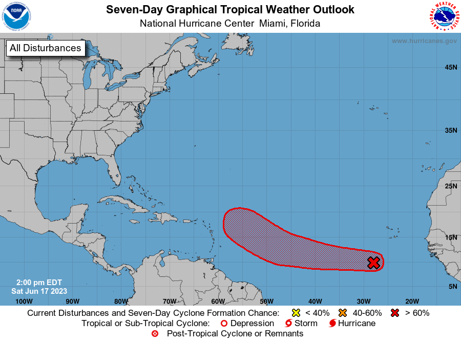
In fact, in the latest Tropical Outlook issued by the NHC today, meteorologists at the Miami, Florida-based forecasting center believe there is a 90% chance that a tropical cyclone will form in the next 48 hours. Showers and thunderstorms have become better organized in association with a broad area of low pressure located several hundred miles southwest of the Cabo Verde Islands; the NHC says that environmental conditions appear conducive for additional development, and a tropical depression or tropical storm is expected to form over the next day or so. This system is forecast to move westward at 15 to 20 mph across the central tropical Atlantic with further development through the middle part of the week.
It is very unusual to have a storm form so far east and south in the Atlantic so early in the hurricane season and what could be Bret ’23 may beat Bret from 2017, which formed on June 19 that year. June 22, 1979’s Ana and an unnamed storm that hit Trinidad in 1933 which formed on June 25 are the only other June systems on record to form south of 23.5°N and east of 60°W.
The GFS and ECMWF are among many computer models meteorologists use to assist in weather forecasting. While meteorologists have many tools at their disposal to create weather forecasts, two primary global forecast models they do use are the ECMWF from Europe and the GFS from the United States. While the models share a lot of the same initial data, they differ with how they digest that data and compute possible outcomes. One is better than the other in some scenarios, while the opposite is true in others. No model is “right” all the time. Beyond the ECMWF and GFS models, there are numerous other models from other countries, other academic institutions, and private industry that are also considered when making a forecast.
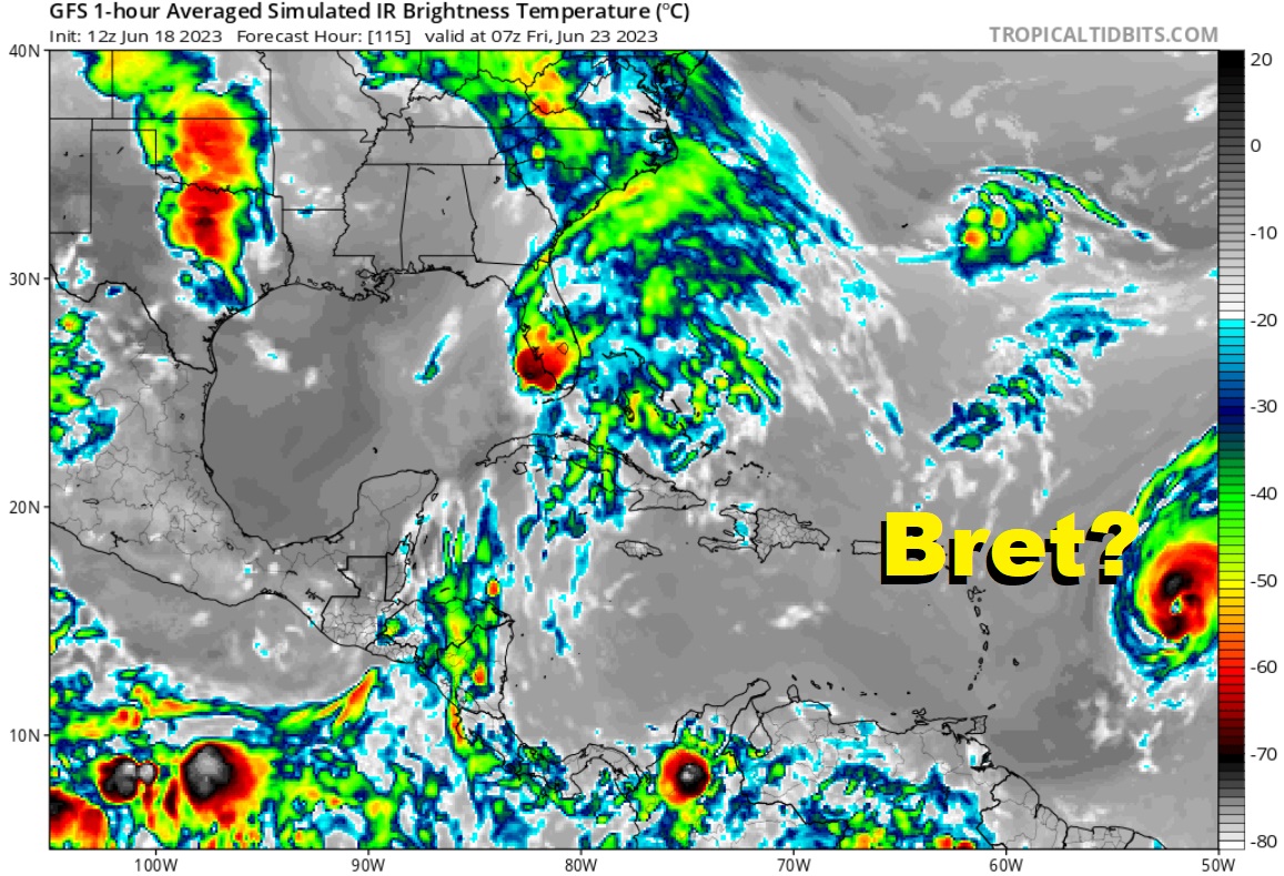
The ECMWF has been showing an impressive, intense storm forming with time in prior model runs; however, in the most recent run, it’s suggesting a weaker storm making its way to the the Caribbean Sea.
The GFS model is showing a stronger storm, although different ensemble members show different paths in the future, some taking it to the north of the islands, others through them.
It is still too soon to know which model output will be the more accurate.
While the National Hurricane Center officially forecasts it to become a tropical cyclone in the next day or two, it is still far from land. Even the fastest model keeps the center away from any Caribbean island for at least 96 hours, giving residents and visitors plenty of time to wait, watch, and prepare for what this next system of the hurricane season will do.
The Atlantic Hurricane Season runs through to the end of November.
