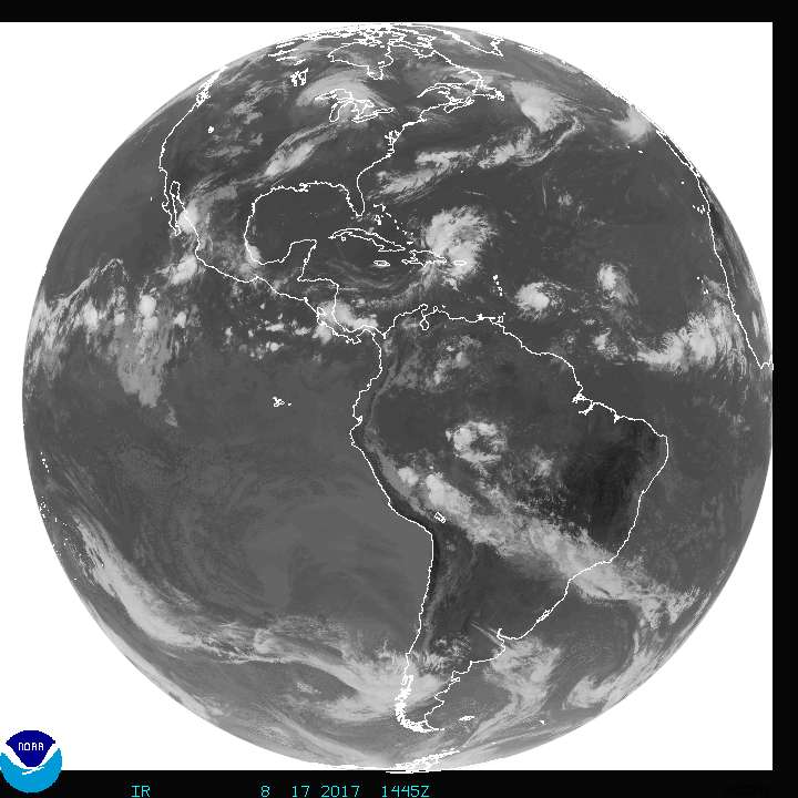
The National Hurricane Center (NHC) and Central Pacific Hurricane Center (CPHC) are tracking four tropical cyclone threats in their respective hurricane basins today and some may have direct impacts on the US coastline over time.
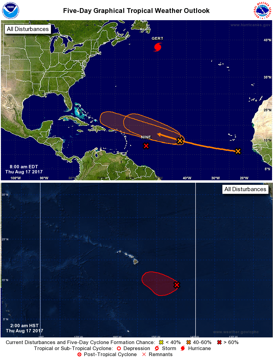
The threat closest to the United States today is a disturbance approaching Hawaii. Showers and thunderstorms associated with a broad area of low pressure located less than 800 miles southeast of Hilo, Hawaii have become slightly better organized. Environmental conditions appear to remain conducive for additional development of this system during the next few days as it drifts toward the west-northwest. The CPHC believes there’s a high chance of tropical cyclone formation and believe a tropical depression can form later today or tonight. Over time, this system could approach the island of Hawaii and the rest of the state, and residents and visitors there should closely monitor that system. If a tropical storm forms here, it would be called Walaka.
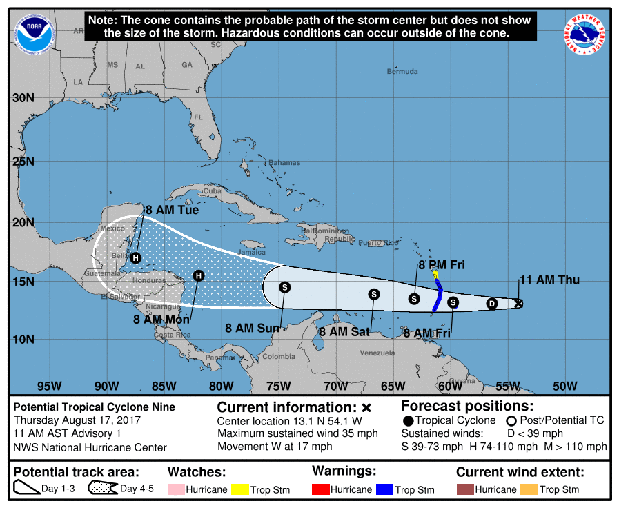
While a tropical depression is organizing near Hawaii, another one is developing near the Lesser Antilles promoting the NHC to begin issuing updates on Potential Tropical Cyclone #9. Satellite imagery, including experimental 1-minute data from GOES-16, indicates that the circulation of the low pressure area east of the Lesser Antilles is becoming better defined, and that a cluster of strong convection has formed just west of the center. The potential exists for this system to become a Tropical Storm soon; if it were to be named, it would be called Harvey. An Air Force Reserve Hurricane Hunter aircraft is scheduled to investigate the system this afternoon, and it is likely the aircraft will find a tropical cyclone has formed.
This tropical cyclone is forecast by the NHC to move off to the west; residents and visitors in the Caribbean should keep a watchful eye on it. A deep-layer ridge to the north of the system should steer it generally just north of due west through the next several days; as such, this storm is forecast to pass through the Lesser Antilles and into the eastern Caribbean Sea in 24-36 hours, into the central Caribbean by 72 hours, and to the western Caribbean by 4-5 days.
The NHC has low confidence in the future strength of this system due to conflicting model guidance. The system is in an area of moderate easterly vertical shear, and the large-scale models suggest that light/moderate shear should continue through the forecast period. This seems favorable for strengthening, and the SHIPS and LGEM models show slow, but steady, intensification. However, the American GFS and European ECMWF models forecast the system to degenerate to an easterly wave over the central Caribbean Sea, possibly due to dry air entrainment.
Beyond what could be Walaka and Harvey, the National Hurricane Center is tracking two other systems in the Atlantic Ocean that could become tropical cyclones this week.
Shower activity associated with an area of low pressure located about 1200 miles east of the Leeward Islands continues to show signs of organization. Gradual development of this system is possible during the next day or so while it moves west-northwestward at near 20 mph. After that, upper-level winds are expected to become less conducive for development. The NHC says there’s a 60% chance that this system will form into a tropical cyclone either over the next 48 hours or over the next 5 days.
A tropical wave located over the far eastern Atlantic Ocean near the Cabo Verde Islands is producing disorganized showers and thunderstorms. Gradual development of this system is possible during the next several days while it moves westward to west-northwestward at about 15 mph. For now, the NHC believes there’s a low chance of formation, pegging the odds at 30% for tropical cyclone formation over the next 5 days. Nevertheless, the system needs to be watched, especially beyond the 5-day forecast period.
Before any threat arrives on US shores, residents should make sure their Hurricane Action Plan is in order.
Experts believe this Atlantic Hurricane Season, which runs through to the end of November, will be a busy one. Dr. Phil Klotzbach and the experts at Colorado State University updated their seasonal outlook again on July 5, showing a much more active than normal season expected. The National Oceanic and Atmospheric Administration (NOAA) also released their own forecast which shows this hurricane season to be likely more active than others.
