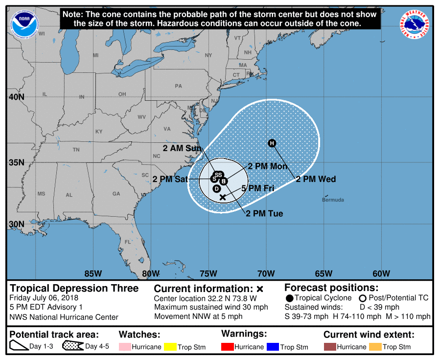
The National Hurricane Center upgraded the disturbance off the Carolina coast to the third tropical depression of the 2018 Atlantic Hurricane Season earlier today; now they believe the storm will strengthen to a Tropical Storm, be named Chris, and intensify further to hurricane status by Wednesday afternoon. Fortunately, it should linger far enough shore to avoid bringing direct impacts to adjacent coastal waters in South Carolina, North Carolina, Virginia, Maryland, Delaware, or New Jersey. However, indirect threats, such as rough seas, rip currents, and coastal beach erosion are all possible as this system spins about and lingers east of the Mid Atlantic Coast for the next several days.
According to the National Hurricane Center, most of the computer guidance they rely on suggests that the tropical-storm-force winds associated with the cyclone will occur in the eastern quadrant well away from the U.S. coast. On this basis, no watches or warnings are required for the U.S coast at this time. However, the National Hurricane Center believes interests along the North Carolina coast should closely monitor the future progress of this system in the coming days should things change.
The National Hurricane Center is also tracking Hurricane Beryl. Like Chris, it is not expected to make direct impacts to U.S. interests in the immediate future, although that could change as we enter the new week next week.
Meanwhile, people up and down the entire East Coast and Gulf Coast should make sure they have a Hurricane Action Plan. The 2018 Atlantic Hurricane Season runs through to the end of November.