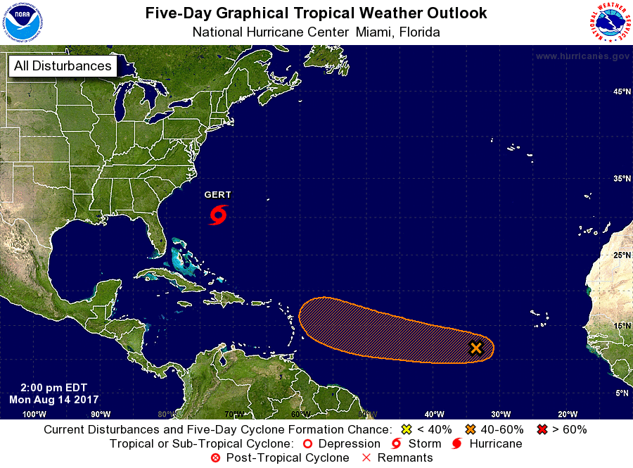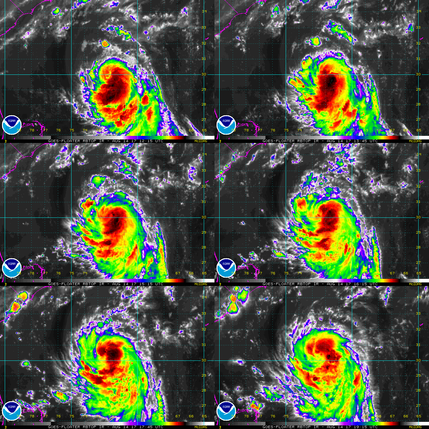
Tropical Storm Gert continues to gain strength in the Atlantic and is forecast to become a hurricane soon; meanwhile, the National Hurricane Center (NHC) continues to watch a new disturbance which may pose an even larger threat to the United States as Hurricane Harvey.
Tropical Storm Gert is now moving toward the north. Very little change has been made to the NHC track forecast. Gert should continue to move around the western periphery of the subtropical ridge for the next day or so, before rapidly accelerating eastward ahead of a trough.
Despite the presence of moderate northerly vertical wind shear, there is good agreement among the intensity guidance that Gert will continue to strengthen for the next 48 hours. The NHC forecast gives more weight to the modest intensification scenario proposed by various forecast models and officially calls it to become a hurricane soon.

All of the global models show extratropical transition beginning in just under 2 days and completing in about 3, After extratropical transition completes, Gert is still expected to steadily weaken before being absorbed by a larger extratropical low in about 4 or 5 days.
While Gert is not expected to directly impact the US East Coast nor Bermuda, rough surf and rip currents are expected to make their way to both coasts this evening. Swimmers and boaters from New England south to Florida should exercise extreme caution when entering the Atlantic.
Meanwhile, while Gert spins up between the US East Coast and Bermuda, eyes are on a new disturbance in the far Atlantic. Showers and thunderstorms associated with an elongated area of low pressure located several hundred miles west-southwest of the Cabo Verde Islands have changed little in organization since this morning. Environmental conditions are expected to be generally conducive for development during the next several days while the disturbance moves westward at about 15 mph over the tropical Atlantic. While the chance of formation is low at about 30% for the next 48 hours according to the National Hurricane Center, the chance of formation over the next 5 days is high at 60%.
Many global forecast models, including recent runs of the European ECMWF, American GFS, and Canadian GEM, have suggested that this new disturbance will become a potent tropical cyclone, with some runs in recent days suggesting it would landfall on the US as a hurricane. While the storm is at least a week away from nearing US waters, and it is too soon to put much faith in extended guidance at this time, it is important that people anywhere on the US East Coast or Gulf Coast have a hurricane action plan prepared.
Should this disturbance in the Atlantic become a named tropical cyclone, it would be called Harvey.
Experts believe this Atlantic Hurricane Season, which runs through to the end of November, will be a busy one. Dr. Phil Klotzbach and the experts at Colorado State University updated their seasonal outlook again on July 5, showing a much more active than normal season expected. The National Oceanic and Atmospheric Administration (NOAA) also released their own forecast which shows this hurricane season to be likely more active than others.