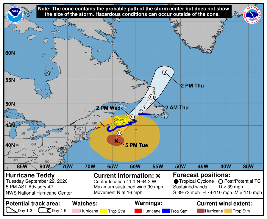
The National Hurricane Center is describing Hurricane Teddy as a “ginormous” storm; the center of the 1,000-mile wide storm is due to make landfall over Nova Scotia during the next 24 hours. With the arrival of the system, the Canadian Hurricane Centre has issued a Tropical Storm Warning from Port aux Basques to Francois, Newfoundland in addition to the warning that’s in effect on Nova Scotia’s south coast from Digby to Meat Cove.
In the latest update from the National Hurricane Center, the center of Hurricane Teddy was located near latitude 41.1 North, longitude 64.2 West. Teddy is moving toward the north near 16 mph (26 km/h), and a turn toward the north-northeast is expected by early Wednesday. On the forecast track, the center will move over eastern Nova Scotia on Wednesday, and then near or over Newfoundland by Wednesday night, and be east of Labrador on Thursday.
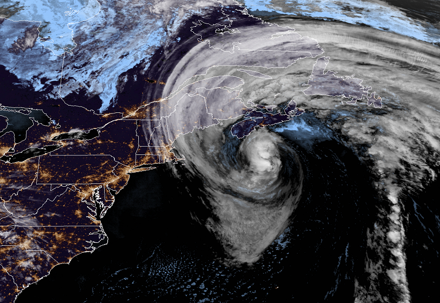
While the center is still well south of Nova Scotia, strong winds from the storm are already over all of Nova Scotia. In addition, tropical storm force winds are being recorded in eastern New England along northeast Maine and far eastern Massachusetts. For now, Teddy’s maximum sustained winds are near 90 mph with higher gusts. Although some weakening is likely tonight and Wednesday, Teddy should be a strong post-tropical cyclone when it moves near and over Nova Scotia.
Teddy is forecast to bring dangerous storm surge, rough surf, damaging winds, and heavy rain to eastern Canada over the next 24 to 36 hours. A dangerous storm surge is expected to produce significant coastal flooding near and to the east of where the center makes landfall in Nova Scotia. Near the coast, the surge will be accompanied by very large and destructive waves. Large swells generated by Teddy are affecting Bermuda, the Lesser Antilles, the Greater Antilles, the Bahamas, the east coast of the United States, and Atlantic Canada. These swells are likely to cause life-threatening surf and rip current conditions. Through Thursday, Teddy is expected to produce rainfall accumulations of 2 to 4 inches (50 to 100 mm) with isolated totals of 6 inches (150 mm) across sections of Atlantic Canada. Such heavy rain over this terrain could lead to flash flooding and rockslides.
