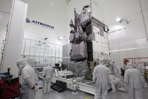
Scientists associated with the Proving Ground for GOES-R are getting excited for the technological advances contained in this next-generation weather satellite due to launch in the coming weeks.
Dr. Stephan Goodman PhD, the Chief Program Scientist for GOES-R at NOAA Satellites tells us, “NOAA’s National Weather Service meteorologists are really looking forward to GOES-R’s ability to offer 3x more spectral channels with 4x greater resolution, 5x faster than ever before. GOES-R will carry the first operational lightning mapper ever flown in space. And, GOES-R can multi-task. The satellite will scan the Western Hemisphere every 15 minutes, the Continental U.S. every 5 minutes, and areas of severe weather every 30-60 seconds, all at the same time. NOAA’s meteorologists will be able to use the data and information flowing from this satellite, which is 22,000 miles above the Earth, to give people around the country better and more accurate forecasts.”
GOES-R will offer huge advances in weather analysis and forecasting but how will it be used and what will forecasters do with all this new data once it is available? This is a bit more complex than your simple plug and play devices you may use at home or even the new weather graphical computer you may see introduced from time to time on-line and on TV. In that case it might take a quick look at the instruction guide or a few days training and the new operators are good to go. GOES-R is a bit more complex but thanks to a tremendous amount of training, testing, analyzing and retesting, the vast new data should be utilized as best it can be from day 1.

This pre-launch period is known as the GOES-R Proving Ground and it has been going on for a number of years now. What it is is a way to simulate and test the wide range of new products that will be available as soon as GOES-R becomes operational. The next generation of satellite technology will continue to work at creating better forecasts, longer lead warning times along with finding better methods to analyze and forecast our weather and climate. The last thing the National Weather Service would want is for the operational forecasters to be seeing the new products on the day the satellite becomes operational.
The proving ground is composed of two groups, providers and consumers. Within NOAA there are many specific institutes that can specialize in certain products. Take for example the Cooperative Institute of Mesoscale Meteorological Studies (CIMMS). They create programs or algorithms that will be able to detect certain features and improve forecasts with the new products that GOES-R will be able to deliver. These products are then tested by the consumers (the operational forecasters) who create reports that are returned to the providers who work to improve the existing algorithms. The goal of this ongoing process is to make sure that the new products will be used as best they can be from the moment they become available.
Beyond new products that will be tested, scientists are also exploring how imagery captured by GOES-R will be taken to a whole new level of analysis. Super Rapid Scan Operations for Goes-R (SRSOR) has prepared limited samples of data used by the proving ground. You may have come across these high resolution visible satellite movies that are shared on social media. These are created on a limited basis to help create better forecasting tools for severe weather detection. By analyzing these created case studies now forecasters will be ready to utilize the widely available rapid scan loops that GOES-R will be able to create.
The excitement will continue to build not only though the launch but the initial test period for the new technology that will become available. When NASA hands operational control over to NOAA after the initial test period it may seem like it is as easy as flipping a switch, but it is not. Hours, days, months, and even years of testing and retesting has gone into making sure forecasters will be able to use the new data from day one of operations.