A tropical disturbance in the Gulf of Mexico is unlikely to develop into a full tropical cyclone, but it is still forecast to add to the flooding woes that are ongoing in the U.S.
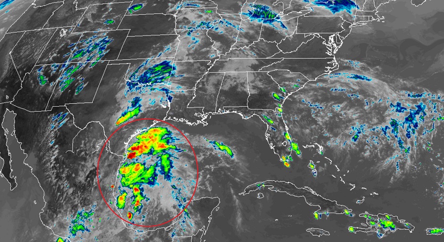
Recent satellite imagery indicates that a broad area of low pressure located over the southwestern Gulf of Mexico remains disorganized. This system is expected to move inland over northeastern Mexico later today or tonight and the chances of development into a tropical depression have decreased. According to the National Hurricane Center, the odds of tropical cyclone formation here are a low 20%. Because there’s little chance in a storm forming, the Air Force Reserve reconnaissance mission scheduled for today has been canceled.
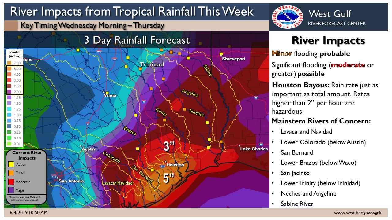
While tropical storm or hurricane force winds won’t be an issue, flooding, soaking rains from the disturbance will be. Regardless of development, the disturbance will likely produce heavy rainfall over portions of eastern Mexico, southeastern Texas and the Lower Mississippi Valley during the next few days. Widespread 1-3″+ rainfall amounts are expected with locally higher amounts of 4-6″ possible. The threat of heaviest rain is in the greater Houston metro area and places just south and west of there.
Scattered thunderstorms with heavier rain will overspread southeast Texas tomorrow. Heavy rain will then spread north into Louisiana and Arkansas on Thursday. Wherever this system goes, tropical downpours with rainfall rates of 2″+/hour could lead to flash flooding. This additional rainfall will only worsen ongoing flooding along the Mississippi River.
Elsewhere in the tropical Atlantic things are quiet; the National Hurricane Center doesn’t expect any tropical cyclone formation anywhere in the Atlantic basin over the next 5 days.
While things may be quiet in the tropics, that may not be for long. Earlier today, experts at Colorado State University released an update to their April outlook for the current hurricane season; that update increases the number of storms expected in the basin.
