The Gulf of Mexico could be an area of trouble as the 2018 Atlantic Hurricane Season continues. Meteorologists with the National Hurricane Center (NHC) have been monitoring an area of disturbed weather near Central America for many days. Odds are increasing that this disturbance will make its way north into the Gulf of Mexico and become a tropical cyclone in the process.
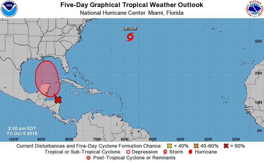
Eyes are on a broad area of low pressure centered near the northeastern coast of Honduras. The disturbance is drifting northwestward and producing disorganized shower and thunderstorm activity from Central America east-northeastward across the Western Caribbean to Hispaniola. According to the NHC, although strong winds aloft persist just to the north of the system, the upper-level environment is expected to be conducive enough to allow slow development.
Some forecast models are suggesting development could be robust in the coming days. Both afternoon runs of the American GFS and European ECMWF show a hurricane forming and making landfall somewhere along the central or eastern Gulf coast by the end of next week.
For now, the NHC is being conservative, saying only that “a tropical depression could form by late this weekend or early next week.” Such a formation would occur over the northwestern Caribbean Sea or Gulf of Mexico while the system moves northwestward to northward. The NHC believes there’s a 40% chance of tropical cyclone formation over the next 48 hours and a 70% chance of formation over the next five days.
In the short-term, regardless of tropical cyclone formation, this disturbance will continue to bring torrential rains primarily to portions of Central America and the Yucatan peninsula during the next few days.
In the long-term, whether or not the system takes on tropical cyclone characteristics, there could be heavy rain and flood threats from this system in the U.S. The greatest threat would be along the central or eastern Gulf coast, but the flood threat could extend into the southeastern U.S., including areas hit hard by Hurricane Florence recently.
