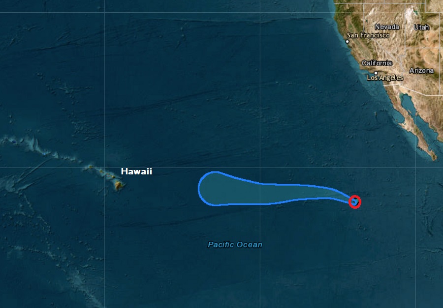
In addition to issuing advisories on Tropical Storm Idalia, the National Hurricane Center (NHC) in Miami, Florida is also issuing advisories on freshly formed Tropical Storm Irwin in the eastern Pacific. With time, this new tropical cyclone could bring rain to Hawaii in about 10 days.
According to the latest advisory from the NHC, Irwin is located about 2,210 miles due east of Hilo on Hawaii’s Big Island. The tropical cyclone, classified as a tropical storm, has maximum sustained winds of 40 mph. The storm is moving to the west-northwest at 10 mph while its minimum central pressure is 998 mb or 29.47″. Because it is over the open waters of the Eastern Pacific and is moving away from Central America, no coastal watches or warnings are in effect.
The NHC expects Tropical Storm Irwin to gain strength in the short-term. However, as the storm marches west closer to Hawaii, it’ll be moving over colder waters and a weakening trend is forecast to occur when that happens. Tropical cyclones feed off of warm sea surface temperatures and there’s a lack of such warm water between where the storm is now and the Big Island of Hawaii.
While current global computer model forecasts, including the American GFS and European ECMWF models, show the storm will lose its tropical cyclone characteristics well before it arrives in Hawaii, what’s left of the storm could bring beneficial rains to at least some of the state in about 10 days.
The Drought Monitor Index across Hawaii is becoming worse and wildfires have become problematic on Maui and Hawaii islands in recent weeks, including a catastrophic and lethal fire in Lahaina that claimed more than 110 lives on August 8.
