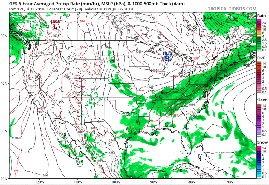
After several days of unrelenting high heat and humidity, Mother Nature will be bringing some relief; however, the cold front bringing that relief could trigger heavy rain as it moves through later this week.
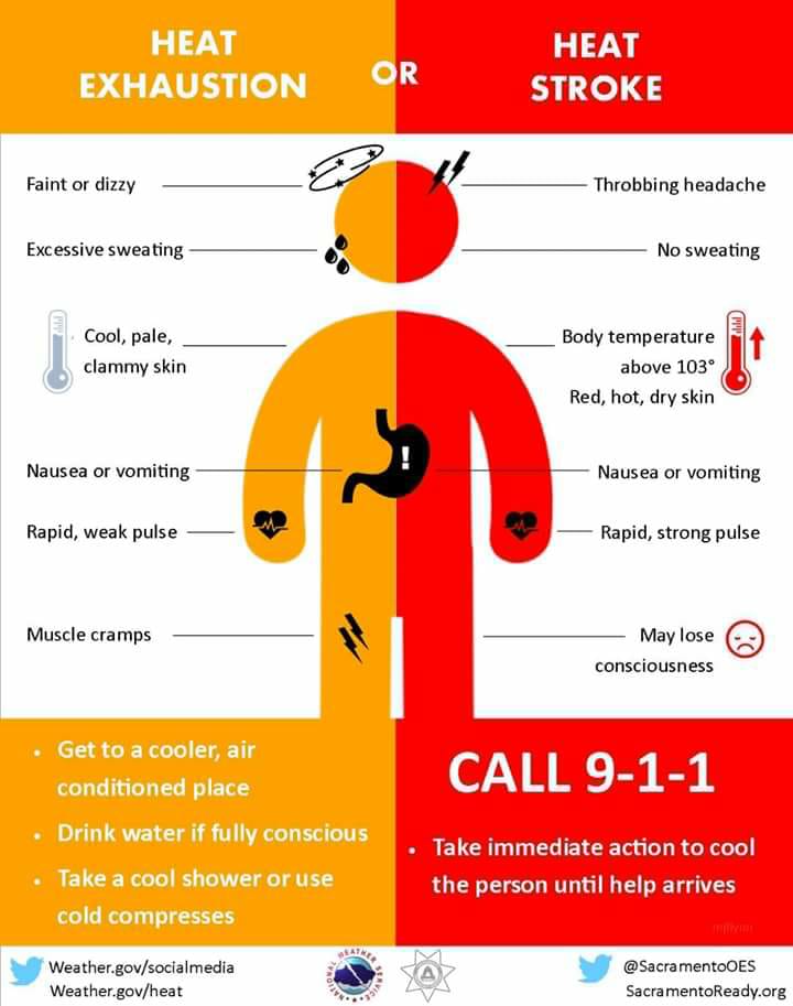
Before relief arrives, today and the holiday tomorrow will continue to feature extreme heat index values which is prompting the National Weather Service to issue a variety of heat-related advisories. With a little more moisture and instability to work with in the atmosphere, it’s possible that some thunderstorms could blossom too in the eastern United States. While isolated, these storms may pack a punch and contain very heavy rain. Slow-moving, soaking storms could create isolated flash flooding conditions. Some of these thunderstorms could interfere with firework displays in portions of the East.
The midlevel pattern will begin to change on Wednesday, as the ridge bringing us the excessive heat the past several days will begin to retrogress into the central U.S. However, the ridge will do this sluggishly, so expect very warm/humid conditions for the rest of the work week, but the trend will be downward with maximum temperatures during the period. With a ridge from the west pushing east, Thursday should be dry for a large part of the eastern US, especially the I-95 corridor between Washington, DC and New York City, NY. Still, even with a relatively dry day, some isolated PM storms can’t be ruled out in this heat.
By Friday, a stronger cold front approaches the area attendant to a progressive vorticity maximum moving into southeast Canada and New England. Deep-layer shear will be quite weak, which will be unfavorable for storm organization but quite favorable for slow-moving, efficient precipitation-producing storms. Computer forecast models suggest more than 2″ of soaking rain could fall, with some amounts even greater possible. Even with a reasonably progressive initiating boundary, training storms are likely along the front as convection regenerates and propagates toward the strongly unstable air to the south and southwest. Training is the process by which storms fire up and move over the same location many times. It will not take much training to cause problems given the high-octane environment downstream of the front. If the front`s passage is slower, this could be a fairly significant flash flood threat, given the anomalous moisture and weak steering flow in place. Favorable timing of the frontal passage does suggest potential for diurnally stronger storms (perhaps some wet microbursts), but heavy rain will be the main threat.
High pressure will build into the area this weekend with fair, dry, and cooler conditions expected. Next weekend will be much cooler and much more comfortable for most people in the eastern US compared to last weekend and this Fourth of July holiday period. However, the cool-down will be short-lived, with more heat returning early next week.
