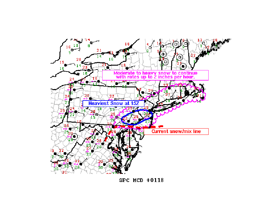
The rough winter of 2021 continues with yet another round of heavy precipitation returning to the Mid Atlantic and southern New England today, with heavy snow being reported in portions of central eastern Pennsylvania and central New Jersey. The National Weather Service’s Storm Prediction Center has issued a Mesoscale Discussion describing the heavy snow falling in Pennsylvania and New Jersey today. In this area, snow could fall at an exceptionally heavy 2″/hour rate.
According to the National Weather Service, an expansive precipitation associated with broad isentropic ascent has overspread much of the mid Atlantic and has started to move into New England. Moderate snowfall rates are being observed across much of the region with heavy snowfall currently being observed in southeast Pennsylvania and central New Jersey. This area of heavy snowfall is expected to pivot northeastward this afternoon across New Jersey and eventually Long Island. The current transition zone between snow and sleet/freezing rain is near the Pennsylvania/Maryland border and across far southern New Jersey. This transition zone is expected to lift northeastward through the day into southeast Pennsylvania, central New Jersey, and possibly to Long Island, bringing a mix of freezing rain and sleet to these areas. Areas to the north of this transition zone will see just plain snow.
While locations more north and west will be cold enough to support all snow, they’ll also be the farthest away from the moisture source located closer to the coast. Because of that, snowfall accumulations will drop off significantly as one heads well north and west of the I-95 corridor into upstate New York and central New England.
More than a half foot of snow has already been reported in portions of New Jersey and Pennsylvania this morning:
Trenton, NJ: 8″
Eatontown, NJ: 6.3″
Florence, NJ: 5.2″
Sea Bright, NJ: 5″
Cranbury, NJ: 3.9″
East Brunswick, NJ: 3″
The snow will wrap up by tomorrow morning from southwest to northeast over southeastern New England. Afterwards, high pressure will provide fair and dry conditions for much of the eastern U.S. for the weekend as temperatures moderate.
