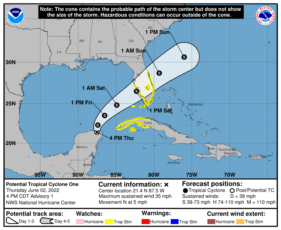
Here comes Alex: the first named system of the 2022 Atlantic Hurricane Season, which just started yesterday, is taking shape in the Gulf of Mexico, prompting the National Hurricane Center (NHC) in Miami, Florida to issue Tropical Storm Watches for the U.S. coast. Right now, known officially as “Potential Tropical Cyclone #1″, the storm is located roughly 505 miles southwest of Fort Meyers, Florida and about 75 miles north-northwest of Cozumel, Mexico. With a minimum central pressure of 1003 mb or 29.62” and maximum sustained winds of 35 mph, the system is moving to the north slowly at 5 mph.
To prepare people in the path of this storm, the NHC has issued a Tropical Storm Watch has been issued for the west coast of the Florida peninsula south of the Middle of Longboat Key and for the east coast of the Florida peninsula south of the Volusia/Brevard County line, including Lake Okeechobee. A Tropical Storm Watch has also been issued for all of the Florida Keys, including the Dry Tortugas and Florida Bay. In Cuba, the government there has also issued a Tropical Storm Watch for the Cuban provinces of Matanzas, Mayabeque, La Habana, Artemisa, and Pinar del Rio, and the Isle of Youth. A Tropical Storm Watch means that tropical storm conditions are possible somewhere within the watch area within 48 hours.
The National Hurricane Center cautions that interests elsewhere in the Florida Peninsula and the northwestern Bahamas should monitor the progress of this system.
As of 5 pm ET, the system was centered near latitude 21.4 North, longitude 87.5 West. The system is only moving to the north at 5 mph now and the NHC expects it to continue that motion and speed tonight. Tomorrow, a turn toward the northeast is expected, with a faster forward speed to the northeast expected by tomorrow night. On the forecast track, the system should move across the southeastern Gulf of Mexico through Friday night, and then move across the southern and central portions of the Florida Peninsula on Saturday.
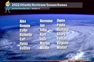
The NHC says maximum sustained winds are near 35 mph with higher gusts now but expects the system to grow over the next 24 hours. The system is expected to become a tropical depression on Friday and a tropical storm late Friday or Friday night. When the system becomes a Tropical Storm, of which the NHC says there is a 90% chance it’ll happen, the storm will be given the first name of the 2022 Atlantic Hurricane Season: Alex.

Alex will bring heavy rain, strong winds, and the threat of storm surge flooding to Florida this weekend.
The storm is expected to produce heavy rains over the eastern portions of the Yucatan Peninsula, the Cayman Islands and western Cuba through Friday. Heavy rains will begin to affect South Florida and the Keys Friday and continue through Saturday. Eastern portions of the Yucatan Peninsula and the Cayman Islands will see 2-4″ with isolated maximum amounts of 6″ possible. In western Cuba, 6-10″ is expected with isolated amounts of 6-10″ possible. Rain this heavy in Cuba could cause life-threatening flash flooding and mudslides. In south Florida, including the Keys, 4-8″ of rain is possible with isolated amounts up to a foot of rain. The rain in Florida could produce considerable flash and urban flooding especially across the urban corridors.
Tropical storm force wind conditions are possible within the watch area in Cuba on Friday, and in the watch area in Florida by Friday night or Saturday morning.
The combination of storm surge and the tide will cause normally dry areas near the coast to be flooded by rising waters moving inland from the shoreline. If the peak surge occurs at the time of high tide, Marco Island, Florida to Card Sound Bridge could see a 1-3′ surge while the area from the Middle of Longboat Key to Marco Island could see a 1-2′ surge. In Charlotte Harbor, a 1-2′ storm surge is possible; the same is true for the Florida Keys and the Dry Tortugas, where a 1-2′ surge is possible too. Surge-related flooding depends on the relative timing of the surge and the tidal cycle, and can vary greatly over short distances