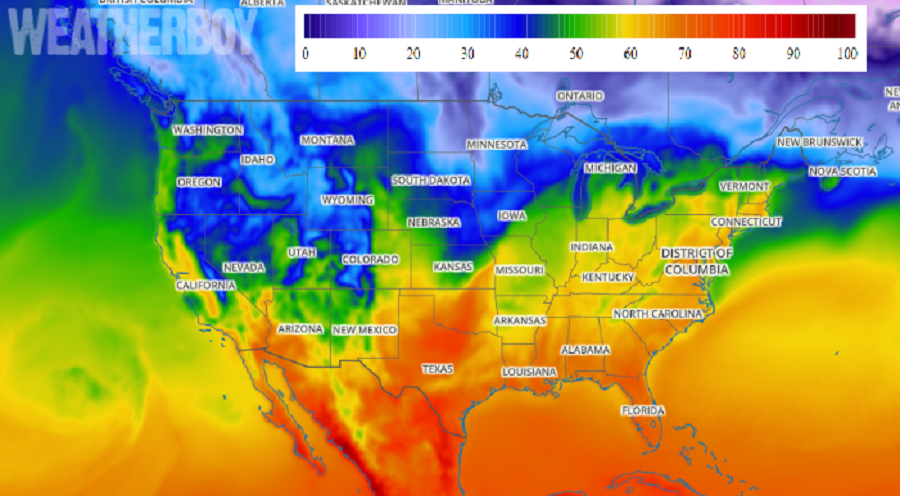
A broad area of high pressure over the eastern United States will warm temperatures up significantly today, with highs in the 80’s expected over the Midwest and Southeast with mild 70’s surging north up the Mid Atlantic coast. Known as a Bermuda High, this type of weather pattern could bring uncomfortably hot and humid air up the East Coast; but with spring here, conditions will be quite nice.
Normally, with a southwest flow behind a Bermuda High, surface dewpoints rise, as is typically the case in the summer. However, with today’s atmospheric set-up, the airmass over the Southeast and Mid- Atlantic has dewpoints generally in the 20s. Combined with afternoon heating and atmospheric mixing, today will feature warm but very dry conditions.
The mild weather doesn’t come without issue though. In portions of the Mid Atlantic, minimum Relative humidity values this afternoon will be 15 to 25 percent and winds may gust up to 20 mph. The combination of low humidity, gusty winds and drying fine fuels will lead to an enhanced threat for fire spread today. Because of that threat, the National Weather Service is issuing alerts and statements about fire weather dangers today.