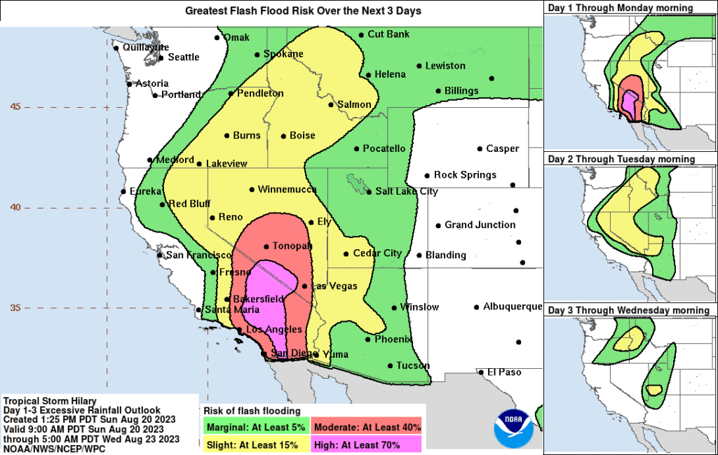
The National Weather Service and USGS are reporting multiple concurrent hazards happening in California and across the broader U.S. Southwest and Baja California due to the presence of Tropical Storm Hilary and an unrelated strong earthquake.
According to USGS, a magnitude 5.3 earthquake struck roughly 75 miles south of Bakersfield, California and about 45 miles northwest of Los Angeles, California at 2:41 pm. The National Weather Service’s Tsunami Warning Center in Palmer, Alaska issued a bulletin to announce there was no tsunami danger from this earthquake. There have been 53 other earthquakes related to this one ranging in magnitude from 1.3 to 4.0. More than 10,000 people have reported experiencing shaking throughout central and southern California and western Nevada from the primary earthquake to USGS via their “Did you feel it?” website reporting tool. According to USGS, moderate shaking and light damage rocked the areas around Ojai, Santa Paula, and Ventura.
In addition to damaging wind gusts from the tropical storm, there is also a threat of tornadoes in southern California as #Hilary advances north. Stay safe! You may not have much or any warning from these quickly forming twisters! https://t.co/qoYPslAzF6
— the Weatherboy (@theWeatherboy) August 20, 2023

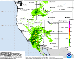
While more aftershocks are likely from today’s earthquake, catastrophic flooding throughout a large area will be the primary life-threatening hazard in the region. Widespread 1.5-2.5″ of rain will fall over a very short time, but localized amounts up to 10″ or more is possible too. That heavy rain will collect and race down valleys, roads, and in and through communities, creative extensive flooding conditions in both urban and rural areas.
Damaging wind gusts are also possible as the storm advances north. Trees in saturated soil may tumble, blocking roads and knocking down utility lines too. A sustained wind of 47 mph with a gust of 70 mph was reported at Sill Hill, California. A sustained wind of 47 mph with a gust of 72 mph was reported at Hauser Mountain, California. Tropical-storm-force winds extend outward up to 230 miles from the center of the storm.
Tornadoes are all possible in the path of Tropical Storm Hilary and its remnants as it pushes north. The National Weather Service has already issued Tornado Warnings for portions of southern California and more are possible as the core of the storm system moves north.
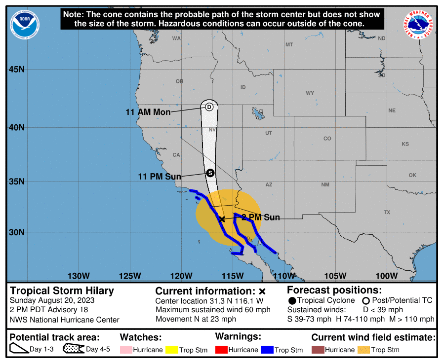
At 2:oo pm, the center of Tropical Storm Hilary was located inland near latitude 31.3 North, longitude 116.1 West, putting it about 115 miles south-southeast of San Diego, California. Hilary is moving toward the north near 23 mph and the storm is expected to accelerate even more as it moves north-northwestward to northward during the next day or so. On the forecast track, the center of Hilary will move across southern California in the next few hours.
Maximum sustained winds are near 60 mph with higher gusts. Weakening is expected to continue, but Hilary is forecast to remain a tropical storm while it moves across southern California. Hilary is expected to become the first tropical cyclone since 1939 to enter into California as a tropical storm.
