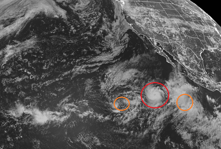
The Eastern Pacific Hurricane Basin has become active again, with three systems being monitored by the National Hurricane Center in Miami, Florida. Of the three, Hilda is the largest and likely next to become the strongest. Currently a tropical storm, the NHC expects Hilda to become a hurricane soon. The system to Hilda’s west, Tropical Depression 9E, is also forecast by the NHC to strengthen soon and become the basin’s next named tropical storm. The third system is located east of Hilda; it isn’t yet a tropical depression, but the National Hurricane Center believes it is likely it will become one in time.
As of the latest update from the NHC, the center of Tropical Storm Hilda was located near latitude 14.1 North, longitude 117.9 West, which is roughly 800 miles southwest of the southern tip of the Baha California peninsula. Hilda is moving toward the west-northwest near 14 mph and this general heading with a gradual decrease in forward speed is expected during the next few days. Maximum sustained winds are near 70 mph with higher gusts. The NHC says that steady strengthening is expected through Sunday, with Hilda expected to become a hurricane later today.
Tropical Depression Nine-E, located about 1, 400 miles west-southwest of the southern tip of the Baja California peninsula, is also expected to gain strength. Maximum sustained winds remain near 30 mph with higher gusts. While the NHC says little if any intensification is expected today, some slight strengthening is forecast on Sunday and Monday, and the depression could become a tropical storm in a couple of days.
Showers and thunderstorms continue to show signs of organization in association with a broad area of low pressure located about 400 miles southwest of the coast of southern Mexico. The NHC says continued gradual development of this system is expected, and a tropical depression is likely to form in a couple of days.This disturbance is expected to move west-northwestward at 10 to 15 mph, away from the coast of Mexico.