Hurricane Agatha is about to strike the Pacific coast of Mexico; after landfall, it is forecast to move across central Mexico and weaken, with its remnants moving near the Gulf of Mexico or Yucatan Peninsula. From there, the National Hurricane Center (NHC) believes redevelopment is possible; in their latest Tropical Outlook, they have boosted odds of development within the Atlantic hurricane basin.

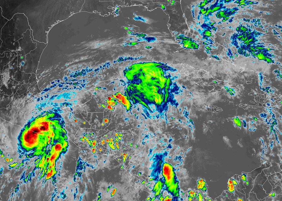
According to the NHC, extremely dangerous coastal flooding from storm surge, accompanied by large and destructive waves, is expected near and to the east of where Agatha makes landfall today. Life-threatening hurricane-force winds are expected in portions of the hurricane warning area in Oaxaca, Mexico, this afternoon and continuing through this evening. Tropical storm conditions have already begun along the coast of Oaxaca and will spread eastward within the warning area through tonight. Heavy rains associated with Agatha will continue over portions of southern Mexico through Tuesday. This will pose a threat of life-threatening flash flooding and mudslides.
In the latest advisory from the NHC, Agatha’s center was located near latitude 15.4 North, longitude 96.9 West, which was 35 miles southwest of Puerto Angel, Mexico. Agatha is moving toward the northeast near 8 mph and this general motion is expected to continue through tomorrow. On the forecast track, the center of Agatha will make landfall in the state of Oaxaca, Mexico, during the next few hours. Maximum sustained winds are near 105 mph with higher gusts. According to the NHC, little change in strength is expected before Agatha reaches the coast of Oaxaca. Rapid weakening is forecast after landfall, and Agatha is expected to dissipate over southeastern Mexico by late Tuesday. The minimum central pressure based on data from the Air Force Hunter aircraft is 974 mb or 28.76″.
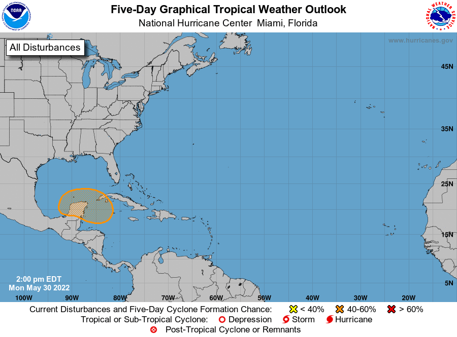
Once Agatha is done lashing Mexico, the NHC says that a large and complex area of low pressure is expected to develop near the Yucatan Peninsula and the northwestern Caribbean Sea in a few days, partially related to the remnants of Hurricane Agatha from the eastern Pacific. This system is forecast to move slowly eastward or northeastward and gradual development is possible by the latter part of this week. Regardless of development, in the short-term, locally heavy rainfall is likely across portions of southern Mexico, the Yucatan Peninsula, Guatemala, and Belize through the week. Right now, the NHC believes there’s a 40% chance of redevelopment/development here over the next 5 days.
Global computer forecast model guidance continue to indicate the chance of redevelopment with time. While the earlier American GFS forecast model suggested the storm would redevelop east of Florida and recurve into the U.S. East Coast, it now suggests development but drives the system out to sea in the Atlantic. The European ECMWF forecast model initially didn’t think the system would develop; however, it now has a tropical cyclone developing in the Gulf of Mexico and impacting Florida before moving up the U.S. East Coast. It is too soon to tell which model is right or wrong or what the eventual future will bring to this system. With the Atlantic Hurricane Season starting on June 1, it is important for anyone in the U.S. along the Gulf and East coasts be prepared for any tropical system this season.
