There’s a risk a hurricane may be brewing next week, and it could impact portions of the U.S. East Coast with time. In their Tropical Update this afternoon, the National Hurricane Center (NHC) in Miami, Florida says there’s a high chance that a disturbance moving across the Atlantic will develop into a tropical cyclone. Global computer forecast model guidance suggests significant intensification over time, perhaps bringing the storm as a hurricane to portions of the southeastern U.S. after the Fourth of July holiday weekend. At 5pm this evening, the National Hurricane Center classified the system as “Potential Tropical Cyclone #5” and issued its first advisory for it.
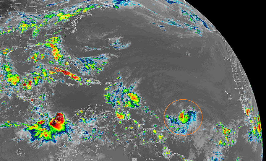
Right now, showers and thunderstorms associated with a broad area of low pressure within a tropical wave are located about 1,300 miles east-southeast of the Windward Islands. The NHC says this disturbance has become better organized since yesterday; however, satellite wind data indicates that the disturbance does not yet have a well-defined circulation. Environmental conditions do appear favorable for development, though, and the NHC says it is likely that a tropical depression or tropical storm will form here within the next day or two. As the fifth named storm of the 2021 Atlantic Hurricane Season, it will be named Elsa. The NHC says there’s a 90% chance of tropical cyclone formation over the next 5 days.
However, with such high odds of a tropical cyclone forming, the Meteorological Service of Barbados has just issued a Tropical Storm Watch for Barbados, St. Vincent, and the Grenadines while the Meteorological Service of St. Lucia has issued a Tropical Storm Watch for St. Lucia. The Government of France has also issued a Tropical Storm Watch for Martinique. A Tropical Storm Watch means that tropical storm conditions are possible within the watch area, generally within 48 hours. According to the NHC, interests elsewhere in the Windward Islands, Leeward Islands, the Virgin Islands, Puerto Rico, the Dominican Republic, and Haiti should monitor the progress of this system. Warnings and additional watches will likely be required tonight and on Thursday.
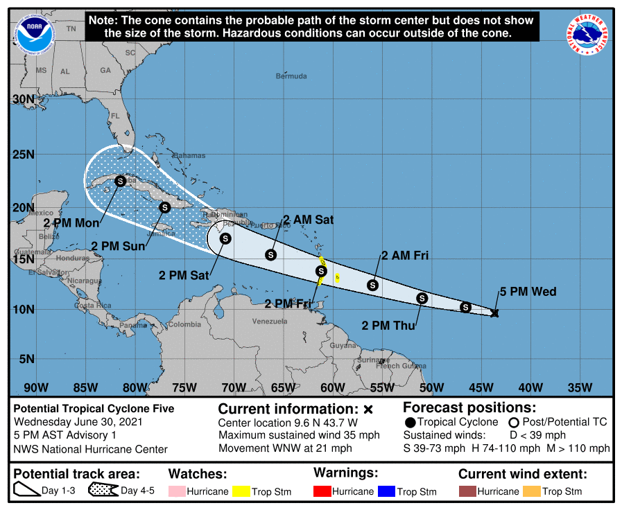
As of the latest advisory from the NHC, the disturbance was centered near latitude 9.6 North, longitude 43.7 West. The system is moving toward the west-northwest near 21 mph and this motion is expected to continue with an increase in forward speed during the next couple
of days. On the forecast track, the system will pass near or over portions of the Windward Islands or the southern Leeward Islands on Friday, move into the eastern Caribbean Sea late Friday and Friday night, and move near the southern coast of Hispaniola on Saturday.
Right now, maximum sustained winds are near 35 mph with higher gusts. The NHC expects some strengthening over the next 48 hours, with the system becoming a tropical storm tonight or tomorrow.
The estimated minimum central pressure is 1008 mb or 29.77″.
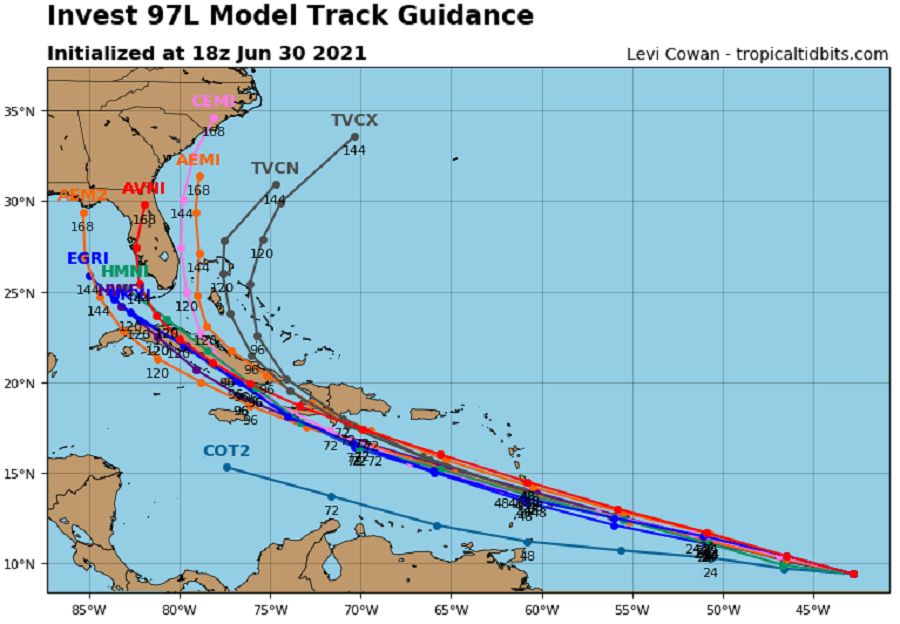
Beyond the holiday weekend, long range computer guidance suggests the storm will strike Florida and move up portions of the East Coast. However, while there is good agreement with the forecast models with such a scenario playing out, it is too early to know with a high degree of certatinty where the system will go. When tropical cyclones interact with the mountainous terrain of Cuba and/or Haiti, there’s a risk the storm direction and/or intensity could change.
For the immediate future, though, attention will be spent on wind and rain issues in portions of the Caribbean. Tropical-storm force wind conditions are possible in portions of the Windward and southern Leeward Islands on Friday. The potential tropical cyclone will produce rainfall totals of 3-6″ with maximum totals of 8″ on Friday across the Windward and southern Leeward Islands, including Barbados. Such heavy rain could produce isolated flash flooding along with mud and rock slides.
The 2021 Atlantic Hurricane Season runs now through to the end of November.
