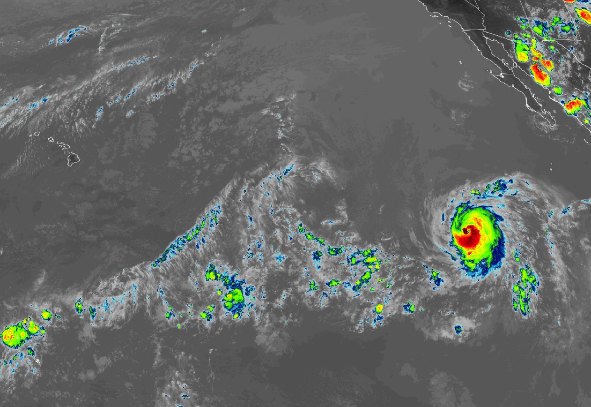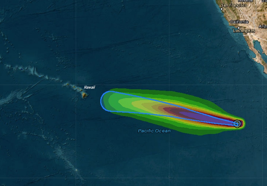
Hurricane Calvin continues to gain strength today as it heads off into the general direction of the Hawaiian Islands. Meteorologists with the Central Pacific Hurricane Center and the Honolulu office of the National Weather Service aren’t yet sure what direct or indirect impacts Calvin will have in Hawaii, but they’re urging people to be prepared for this storm and any other possible tropical cyclone storm that could impact the islands at some point this hurricane season.
As of the latest advisory from the National Hurricane Center (NHC) in Miami, Florida, the center of Hurricane Calvin was located 905 miles southwest of the southern tip of Baja California and was roughly 2,450 miles east-southeast of Hilo. Maximum sustained winds are up to 80 mph while the minimum central pressure is down to 990 mb or 29.24″. The storm is moving to the west at 14 mph. The storm center is located at 12.8 North 118.7 West; once the storm travels west beyond 140 West, it will enter the domain of the Central Pacific Hurricane Center (CPHC) that’ll take over issuing advisories for it from the National Hurricane Center. Forecasters at both centers believe this will happen by Sunday evening.
The National Hurricane Center says a west to west-northwest motion is expected to continue during the next few days while some additional strengthening occurs. While Calvin should become a stronger hurricane in the short term, it is expected to pass over colder water by the weekend, which should help to weaken the system.
In the latest Forecast Discussion from the Honolulu office of the National Weather Service, meteorologist Vanessa Almanza wrote, “It is too early to specify details regarding impacts to the main Hawaiian Islands from Calvin. However, the likelihood of impacts could begin as early as Tuesday into Wednesday of next week. Impacts to the state could include but not limited to high surf, heavy rain, strong winds, or all of the above.”
Right now, the two primary global computer forecast models that meteorologists use to aid in their forecasting, the American GFS and the European ECMWF, both call for Calvin to strike the Big Island of Hawaii, with moisture and windy conditions impacting most of the state soon after. It is likely Calvin would be no stronger than a tropical storm at that point, but due to the volcanic terrain of the Big Island, even a tropical storm could be problematic with damaging wind gusts and heavy rains enhanced by the volcanic peaks there. Whether or not those latest forecast models will verify remains to be seen; the official track of Calvin from the National Hurricane Center only extends through to Tuesday morning, which keeps the center of the storm just east of the Big Island.

Wise advice from the @NWS for people in Hawaii: Now is a great time to prepare for whatever #Calvin or other storms in this hurricane season can bring to the land of aloha:#HIwx https://t.co/5P3SEaMyjq
— the Weatherboy (@theWeatherboy) July 14, 2023