Hurricane Darby has rapidly intensified, becoming a major hurricane with 140 mph maximum sustained winds. The official forecast from the National Hurricane Center brings it closer to the Hawaiian Islands this week, but weakens it as it approaches the Aloha State. Meanwhile, what’s left of Hurricane Bonnie, which isn’t much more than a blob of lingering moisture moving across the Pacific Ocean, is also due to impact Hawaii this week, bringing the potential for very heavy rain to the state, especially to the Big Island of Hawaii and Maui Island.
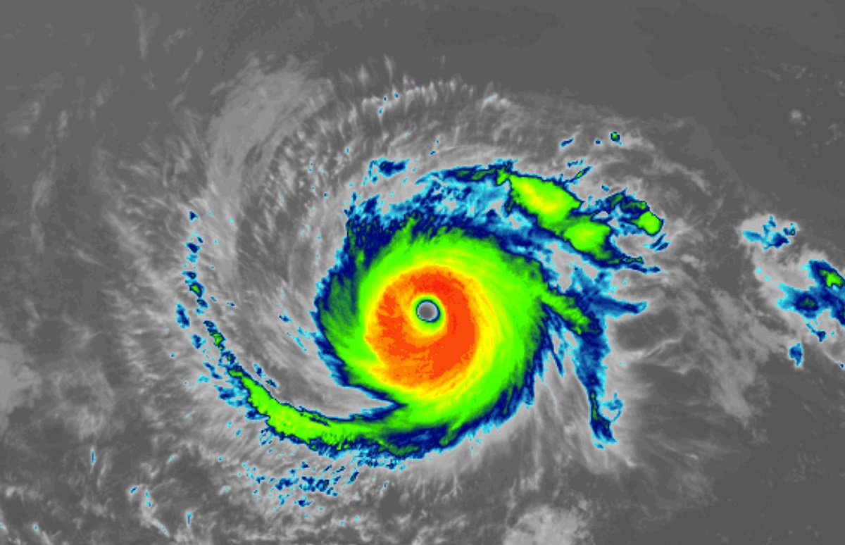
As of the latest advisory from the National Hurricane Center (NHC), Major Hurricane Darby was located at 14.7N, 125.0W, which puts it in the middle of the Pacific Ocean between Mexico and Hawaii roughly 1,135 miles west-southwest of the southern tip of Baja California. The Category 4 hurricane is moving to the west at 15 mph; the minimum central pressure is down to 954 mb or 28.17″.
The NHC says Darby will continue its motion today but begin to turn a bit more west-northwest tomorrow. Additional strengthening is possible and Darby could become a Category 5 hurricane. However, the NHC says the peak intensity will likely occur within the next day or two, but then start to weaken as it moves over colder waters.
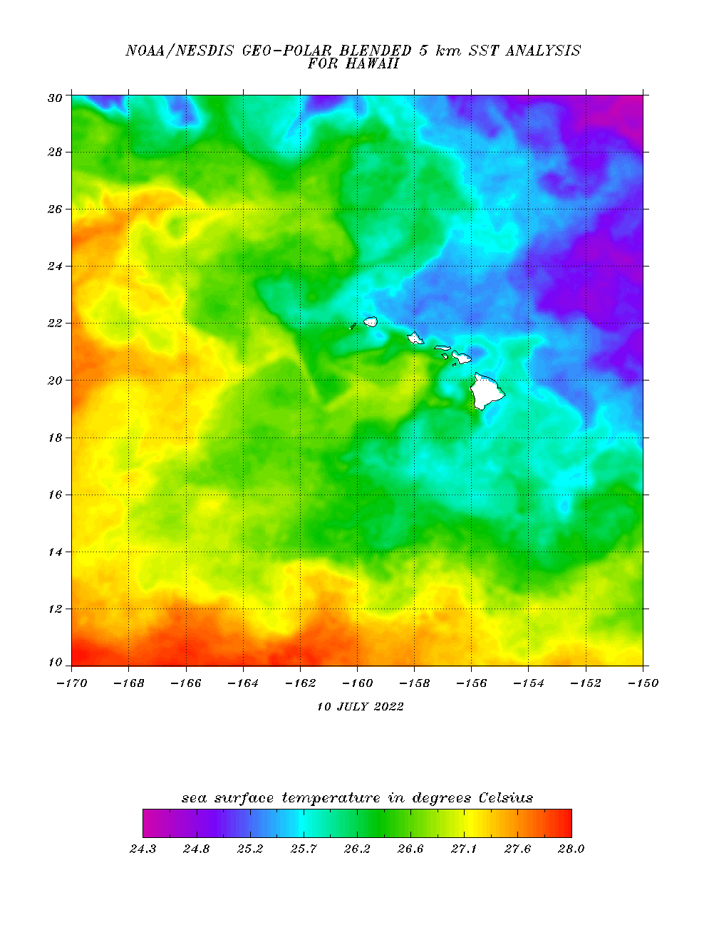
Tropical cyclones need many ingredients to sustain their intensity, with warm seas surface temperatures being a very important factor. Because Darby is forecast to move over significantly colder water as it continues its voyage to the west and northwest in the coming days, it is highly likely that the storm will weaken significantly. In fact, the NHC says in their latest forecast that Darby will weaken to a post-tropical storm before the end of the week.
While Darby won’t approach Hawaii as a full-fledged tropical cyclone, it will still approach as a disturbance rich in deep, tropical moisture. And before Darby arrives, what’s left of Bonnie will arrive too.
Bonnie, which was also a hurricane earlier this month, has long since dissipated. However, moisture associated with the former hurricane continues to drift west over the Pacific. This area of enhanced moisture is due to interact with the islands Wednesday and Thursday, with the Big Island of Hawaii and Maui Islands likely to see the most precipitation from it, with windward sections of Hawaii’s Big Island potentially seeing more than 5″ of rain over a relatively short period of time. The eastern slopes of Mauna Kea and Mauna Loa, Hawaii Island’s largest volcanoes, will help wring-out moisture from the airmass as it slides west, creating a situation where places such as Hilo, Mountain View, Pahala, Volcano, and Honomu could see very heavy rain. Heavy showers could fall across the rest of the islands too, creating concerns throughout Hawaii of not only flash flood issues, but rock slide concerns too.
It appears at this time that what’s left of Darby would approach Hawaii sometime next Sunday and/or Monday. As is the case with Bonnie, most of the precipitation would impact Maui and Hawaii Islands, with the Big Island again in line to see the most rain.
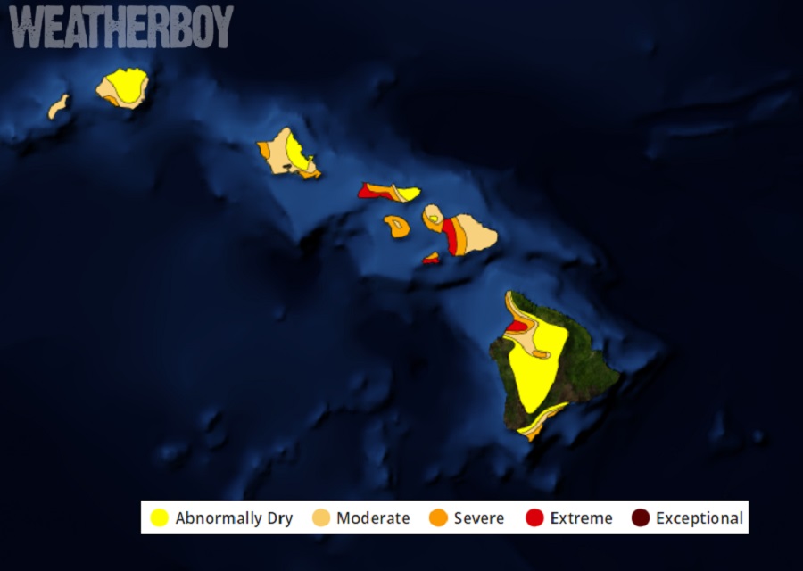
While heavy rain could create problems such as flooding, it will also bring some benefits. Hawaii has been exceptionally dry for many months and any rain will be welcome to quench farms and forests. Getting a significant amount of rain could be beneficial for the drought, especially if it arrives without the tropical storm force or hurricane force winds of a typical tropical cyclone.