Hurricane Darby has unexpectedly intensified today, with maximum sustained winds inside the storm now back up to a 110 mph hurricane, just 1 mph shy of regaining “major hurricane” status. Fortunately, forecasts continue to dramatically weaken this hurricane before it nears Hawaii; however, moisture from it is still due to impact parts of the state later this weekend. Today and tomorrow, tropical moisture from the former Hurricane Bonnie is bringing heavier showers to portions of the islands.
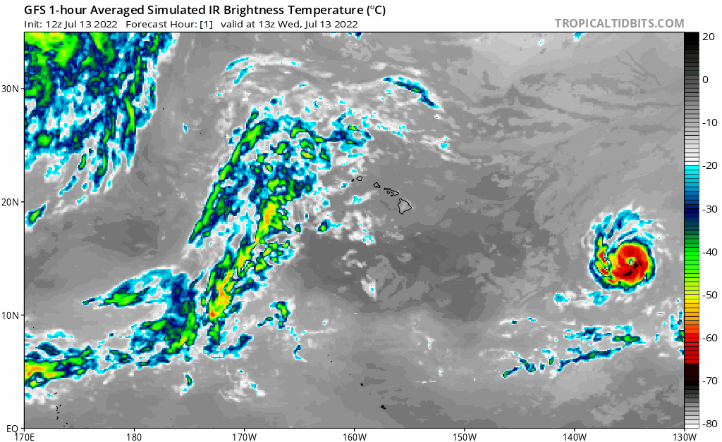
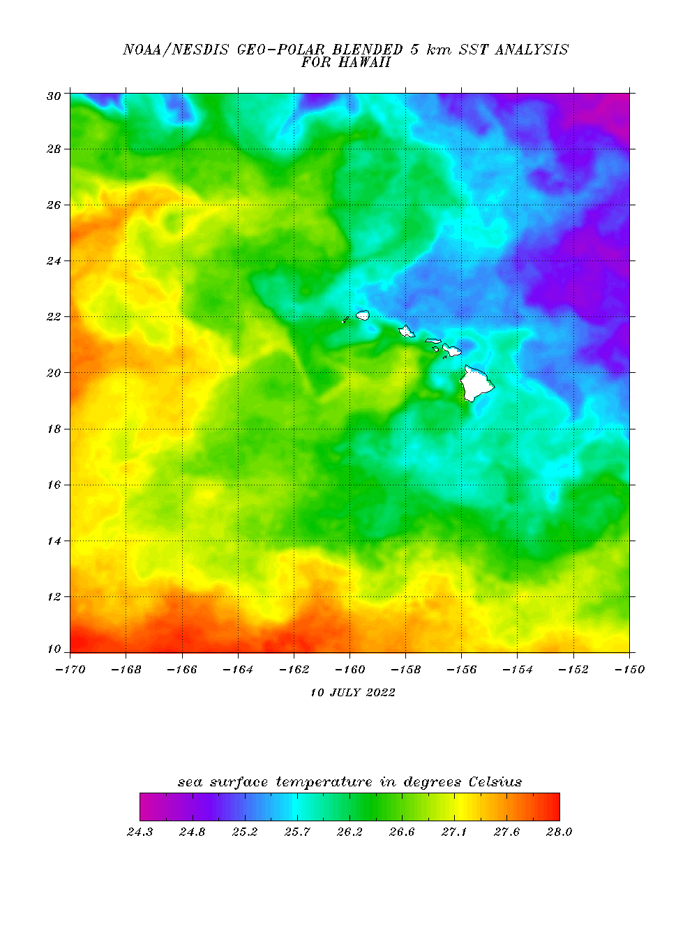
Hurricane Darby is temporarily in an area that supports its intensity: light atmospheric shear, robust moisture, and sea surface temperatures at least in the upper 70s. However, the water becomes much colder between where it is now and the Hawaiian Islands; combined with increasing shear, the environment will become very hostile towards Darby. In about 24 hours, Darby is forecast to move into an area with strong westerly shear and very dry air; at that point, the storm should rapidly weaken. Simulated satellite imagery from the American GFS computer forecast model indicates that the associated convection should dissipate in about 2 days, with Darby becoming a post-tropical low within 3 days.
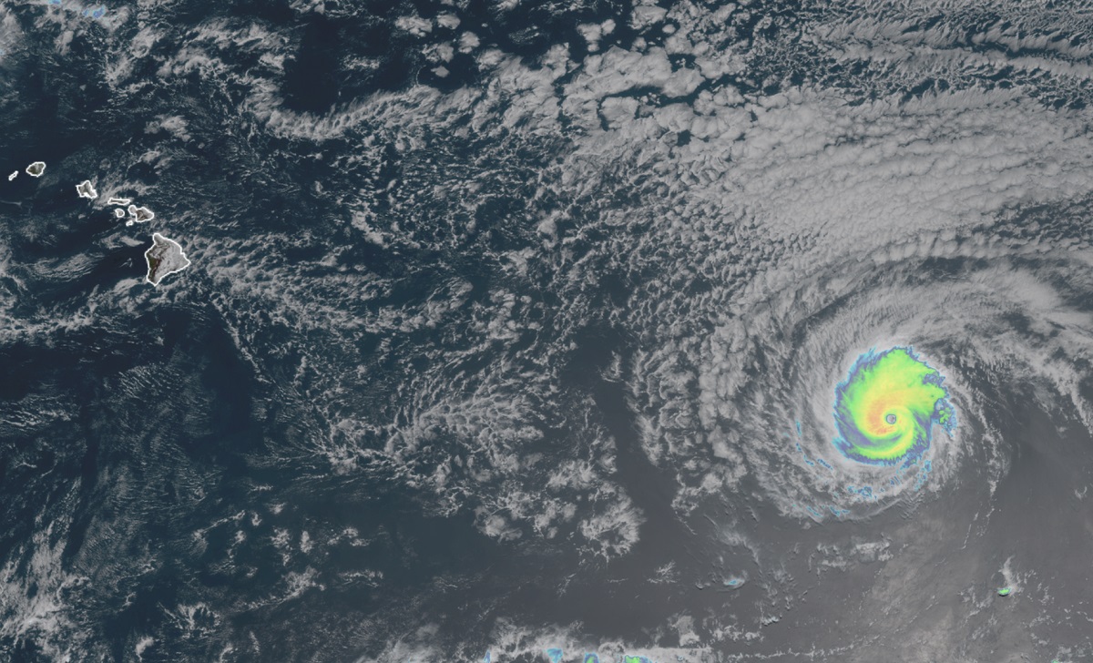
For now, Darby is located roughly 1,245 miles east of Hilo on the Big Island of Hawaii. The 110 mph hurricane is moving to the west-northwest at 15 mph. The storm has an estimated minimum central pressure of 971 mb or 28.68″.
Recent satellite wind data shows that Darby remains a small hurricane. Hurricane-force winds extend outward only up to 10 miles from the center and tropical-storm-force winds extend outward up to 60 miles.
While Darby will no longer be a tropical cyclone when it nears Hawaii, what’s left of it will bring an area of enhanced moisture to the Aloha State. As the system moves from the Eastern Pacific Hurricane Basin to the Central Pacific Hurricane Basin, tracking and forecasting responsibilities will shift from Miami, home to the National Hurricane Center, to Honolulu, where both the Central Pacific Hurricane Center (CPC) and National Weather Service (NWS) for Hawaii reside. Today, the Honolulu-based meteorologists with the CPC/NWS said, “A typical trade wind pattern holds tonight through Friday before the remnants of Hurricane Darby pass south of the Big Island. This will bring a period of locally strong trades and enhanced showers to windward zones, mainly over the eastern end of the state.”
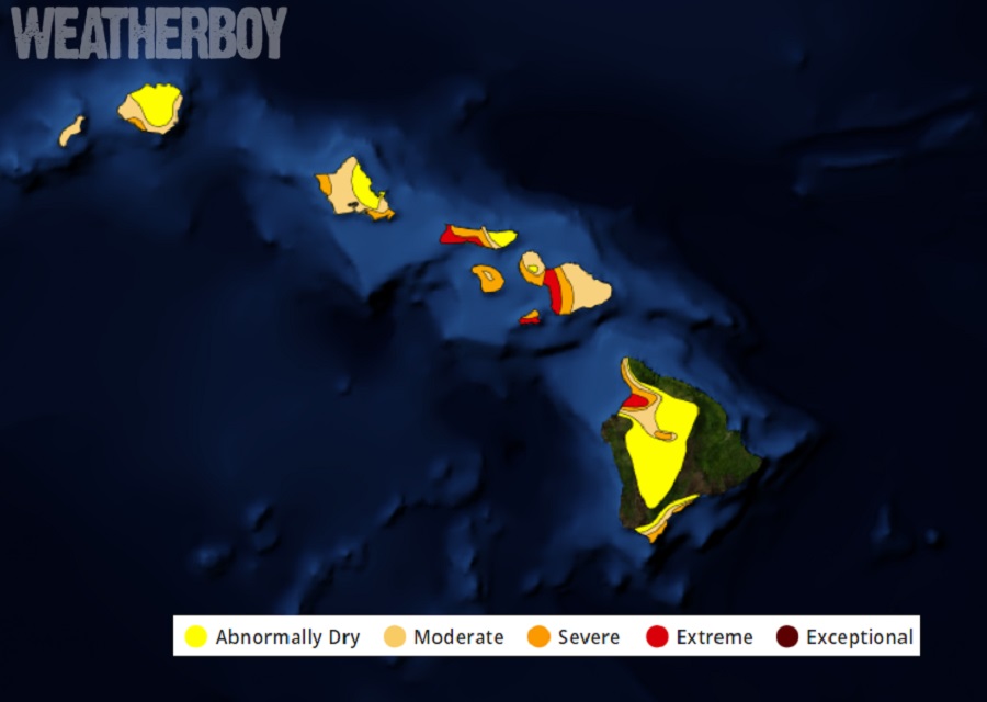
Some heavier showers could create localized flood concerns, along with the threat of isolated rockslides. The rain could also help quench dry soils in Hawaii; much of the state remains under an extensive drought and any precipitation could be welcome.
Before what’s left of Darby arrives from the east in Hawaii, Hawaii is dealing with enhanced showers today and tomorrow from what was once Hurricane Bonnie. Similar to what is expected to happen to Darby, Bonnie rapidly weakened and fell apart as it approached Hawaii. While the tropical cyclone is no more, there is still a substantial amount of moisture left with it. As that moisture interacts with the terrain and air flow around Hawaii, the moisture gets squeezed out as rain onto the state.
While the eastern side of the Big Island will see the most chances of rain and the best odds for heavy rain, enhanced shower activity is possible across the entire state from both systems as the deep tropical moisture passes through.
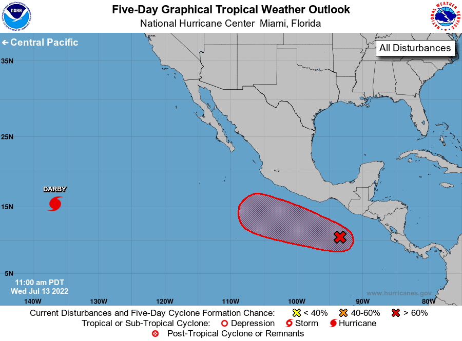
It also appears another system could be developing in the wings, and that system may face a similar fate to Bonnie and Darby. A broad area of low pressure is located a few hundred miles south of the Gulf of Tehuantepec. Shower and thunderstorm activity associated with the disturbance is beginning to show signs of organization and the National Hurricane Center says that environmental conditions appear conducive for additional development. In fact, the NHC says that a tropical depression is expected to form well offshore of the coast of southern Mexico by Friday or Saturday. The disturbance is forecast to drift westward for the next day or two, then move west-northwestward at 10 to 15 mph through the weekend while remaining offshore of the southern and southwestern coasts of Mexico. While it isn’t likely to impact Hawaii at this time, moisture from its remnants could visit Hawaii in about 10-15 days.
