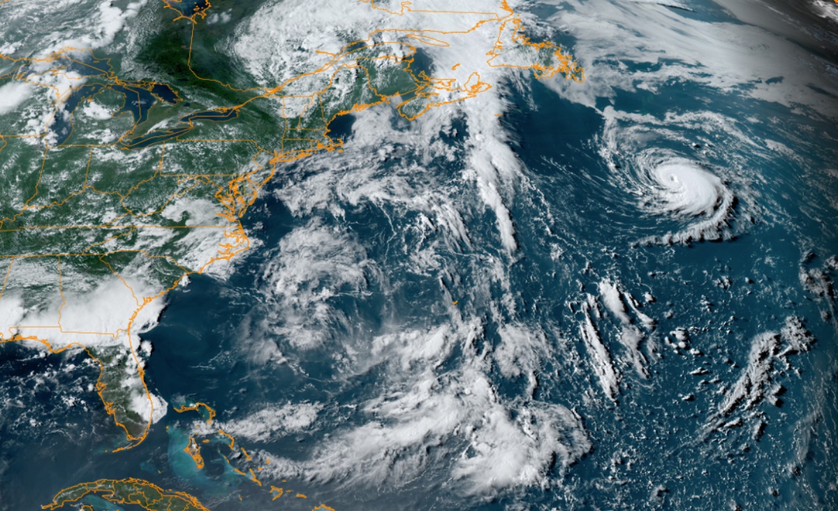
The National Hurricane Center (NHC) upgraded Tropical Storm Don to Hurricane Don today while adding that a new system may also form in the Atlantic Hurricane Basin in the coming days.
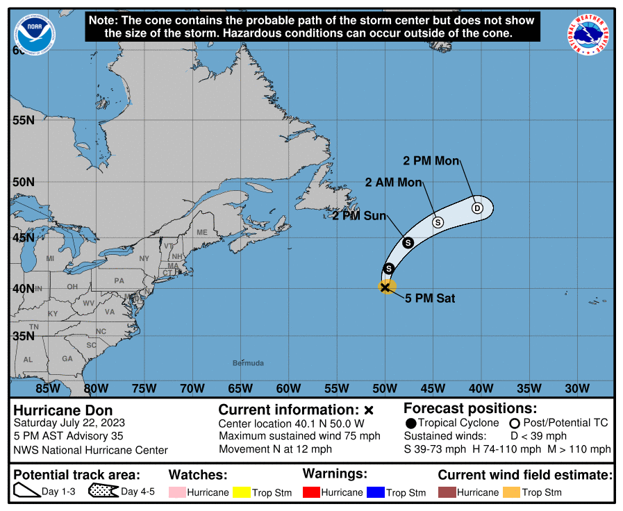
Just before it reached colder waters, the NHC says that Don became a hurricane. As of the latest advisory, Don is located about 480 miles south-southeast of Cape Race, Newfoundland in southeastern Canada. Maximum sustained winds are up to 75 mph making it a category 1 hurricane on the Saffir-Simpson hurricane wind scale. The storm is moving to the north at 12 mph while its minimum central pressure is 988 mb or 29.18″.
There are no coastal watches or warnings in effect for Don nor are any expected. Don is forecast to turn to the northeast later tonight or early tomorrow, and then move northeastward to east-northeastward motion should continue until the system dissipates Monday night or early Tuesday. The storm is not expected to approach any land area while it spins about in the North Atlantic.
Steady weakening should begin later tonight or early Sunday, and Don is forecast to become a post-tropical cyclone Sunday night.
While Don fades away, a new system could be forming. According to the NHC, there is now a 40% chance that a new tropical cyclone will form near the Lesser Antilles over the next 48 hours and a 60% chance that something will form here sometime over the next 7 days. The NHC says shower activity associated with a small area of low pressure located roughly midway between the Cabo Verde Islands and the Lesser Antilles has become a little less organized since yesterday. However, environmental conditions are forecast to remain marginally conducive for some gradual development, and this system could become a tropical depression early next week while it moves westward across the tropical Atlantic. The NHC encourages interests in the Lesser Antilles to continue to monitor the future progress of this system.
