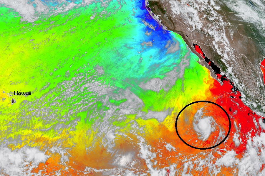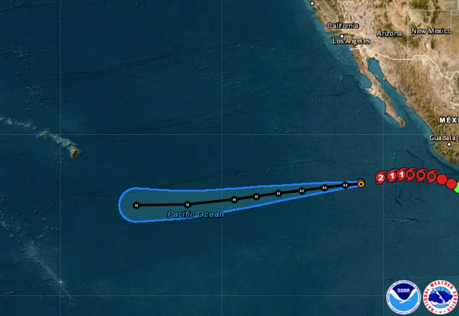
Hurricane Dora has intensified to a category 2 hurricane on the Saffir-Simpson scale and additional strengthening is expected, according to the National Hurricane Center (NHC). The NHC believes the hurricane or its remnants will track well south of Hawaii, but indirect impacts in the form of rough seas and wave action are expected around Hawaii in the coming days.
As of the latest update from the NHC, Dora had maximum sustained winds of 110 mph as it moved west at 16 mph across the open eastern Pacific. Minimum central pressure is estimated at 974 mb or 28.77″. While it’s packing a punch, Dora is a tiny storm; hurricane force winds only extend out about 15 miles from the center while tropical storm force winds extend out to 45 miles. The storm is 2,610 miles east-southeast of Hilo, Hawaii.

The NHC expects Dora to continue its westward to west-southwestward motion for the next several days. While it heads closer to Hawaii, it is also expected to change strength. While maximum sustained winds have increased to near 110 mph with higher gusts now, the NHC says that Dora is forecast to become a major hurricane overnight tonight. Afterwards, a gradual weakening is forecast to begin by Friday.
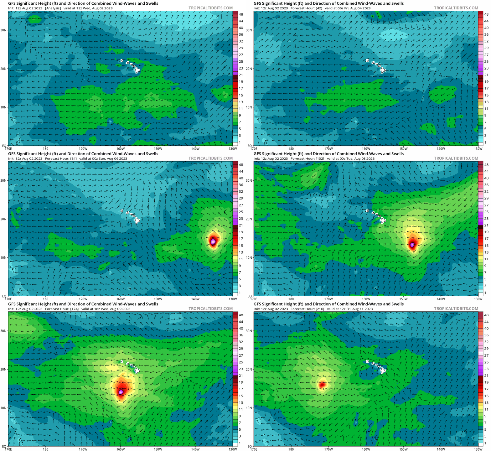
While Dora is expected to pass well south of Hawaii, it is expected to whip up significant waves and swells that will lash Hawaii during the early to middle part of next week, with the Big Island of Hawaii seeing most of the wave action. While much of the swell should remain south of Hawaii, some swell should impact all of the islands in the state.
