Hurricane Ernesto appears to be on a collision course with the island of Bermuda, with the National Hurricane Center (NHC) projecting a direct hit sometime Saturday. However, weather conditions will dramatically worsen today as Ernesto, a very large storm, approaches Bermuda from the south. While Bermuda will see direct impacts from this hurricane, the entire U.S. East Coast is expected to see indirect impacts in the form of hazardous surf and rip currents.
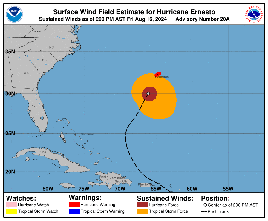
As of the latest advisory from the NHC, Hurricane Ernesto was about 180 miles south-southwest of Bermuda and moving north-northeast at 14 mph. Ernesto had maximum sustained winds of 100 mph with higher gusts while its minimum central pressure was down to 969 mb or 28.61″.
A Hurricane Warning remains in effect for Bermuda.
As Ernesto gets closer to Bermuda, the NHC expects the storm to slow down. A faster northeastward motion is expected late this weekend into early next week. On the forecast track, the center of Ernesto is expected to pass near or over Bermuda on Saturday morning. While some gradual weakening is forecast over the next day or so, the NHC says some re-intensification is possible by early next week.
Ernesto remains a large tropical cyclone. Hurricane-force winds extend outward up to 75 miles from the center, and tropical-storm-force winds extend outward up to 275 miles.
Tropical storm force winds will build in Bermuda today, with hurricane force wind conditions expected tomorrow.
A dangerous storm surge is expected to produce significant coastal flooding on Bermuda in areas of onshore winds. Near the coast, the surge will be accompanied by large and destructive waves.
Ernesto is expected to produce total rain accumulations of 6-12″ in Bermuda with isolated maximum amounts up to 15″. This rainfall will likely result in considerable life-threatening flash flooding, especially in low-lying areas of the island.
Swells generated by Ernesto are affecting portions of the Turks and Caicos Islands, the Bahamas, and Bermuda. Swells are expected to spread up the east coast of the United States later today and continue into the weekend, and could reach portions of Atlantic Canada by late Saturday. These swells are likely to cause life-threatening surf and rip current conditions. “Stay out of the water if advised by lifeguards,” the NHC warns.
