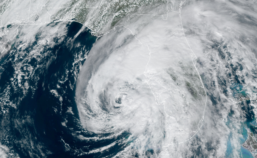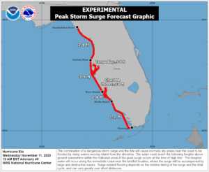
Heavy squalls with tropical storm – force winds are lashing portions of Florida’s west coast as Hurricane Eta approaches the Sunshine State from the Gulf of Mexico. With the threat of significant storm surge imminent, the National Hurricane Center has issued a Storm Surge Warning for Florida’s west coast from the Suwannee River to Bonita Beach, including Tampa Bay and Charlotte Harbor.

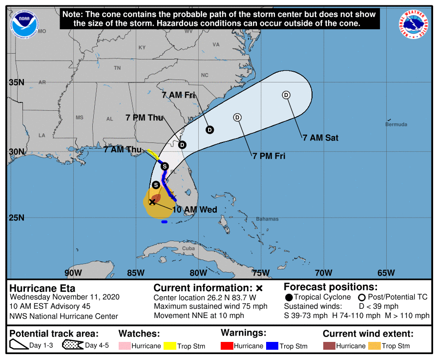
In addition to the Storm Surge Warning, a Hurricane Watch is in effect for Anna Maria Island to Yankeetown while a Tropical Storm Warning is up for the area under the Storm Surge Warning too as well as for the Dry Tortugas. A Hurricane Watch means that hurricane conditions are possible within the next 24 hours while the Tropical Storm Warning means tropical storm conditions are likely over the next 24 hours.
A Storm Surge Warning means there is a danger of life-threatening inundation, from rising water moving inland from the coastline. “This is a life-threatening situation. Persons located within these areas should take all necessary actions to protect life and property from rising water and the potential for other dangerous conditions,” the National Hurricane Center warns. “Promptly follow evacuation and other instructions from local officials.”
The combination of a dangerous storm surge and the tide will cause normally dry areas near the coast to be flooded by rising waters moving inland from the shoreline. The water could reach up to 5′ above ground in parts of the coast if the peak surge occurs at the time of high tide. A 3-5′ storm surge is possible from the Anclote River to Boca Grande, including Tampa Bay; a 2-4′ surge is possible from Boca Grande to Bonita Beach, including Charlotte Harbor and Cape Coral canals. A 2-4′ storm surge is also possible from the Steinhatchee River to the Anclote River; from Bonita Beach to Flamingo, a 1-2′ surge is possible.

For now, Hurricane Eta is moving toward the north-northeast near 10 mph and this general motion is expected to continue through Thursday. On the forecast track from the National Hurricane Center, the center of Eta will move closer to but offshore of the southwest coast of Florida today, approach the west-central coast of Florida tonight, and move inland over the northern portion of the Florida peninsula on Thursday. Eta is expected to move northeastward into the western Atlantic late Thursday or early Friday.
Data from NOAA Doppler weather radars indicate that maximum sustained winds remain near 75 mph with higher gusts. Eta could be near hurricane strength tonight as it approaches the west coast of Florida, with rapid weakening expected after landfall on Thursday. Right now, the estimated minimum central pressure is 983 mb or 29.03 inches.
Hurricane-force winds extend outward up to 60 miles , mainly northeast of the center, while tropical-storm-force winds extend outward up to 115 miles . A sustained wind of 33 mph and a gust to 42 mph were recently measured by a Weatherflow observing station on Sanibel Island. Across the lower Florida Keys, a sustained wind of 39 mph and a gust to 49 mph were recently reported at Sand Key.
Beyond wind and storm surge threats, Eta will bring flooding and the threat of tornadoes.
An additional 2-4″ of rain is possible over west and central Florida through Friday, with some isolated maximum storm total amounts approaching 6″. North and South Florida can both expect an additional 1-2″; isolated totals could approach 4″ in north Florida and 20″ in south Florida. Additional flash and urban flooding will be possible in South Florida, especially across previously inundated areas. Flash,urban, and isolated minor river flooding is expected across portions of West and North Florida through Friday.
A few tornadoes are expected today and tonight over parts of central and western Florida as Eta’s spiraling winds move overhead. There’s also a threat of waterspouts over the Gulf Coast and adjacent bays.