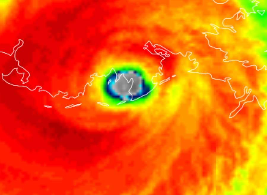
Major Hurricane Ida struck the coast of Louisiana a short time ago at 11:55 am CT, with the eye of the storm reaching land near Port Fourchon with a likely catastrophic blow. With maximum sustained winds of 150 mph, the intense storm, just under Category 5 strength on the Saffir-Simpson hurricane wind scale, continues to pummel Louisiana with rough surf, epic flooding rains, and a historic storm surge. Today’s catastrophe is on the 16th anniversary of another: the landfall of deadly Hurricane Katrina.
Port Fourchon is Louisiana’s southernmost port, located on the southern tip of Lafourche Parish, on the Gulf of Mexico. The seaport plays an extremely important role in the United States petroleum industry, with most traffic from offshore Gulf oil platforms and drilling rings passing through here. The Louisiana Offshore Oil Port pipeline is also located here. Port Fourchon currently services over 90% of the Gulf of Mexico’s deepwater oil production. Also in harms way are the more than 600 oil platforms within a 40-mile radius of Port Fourchon. All in, this port and surround area is responsible for about 16-18% of the entire United States’ oil supply.
The storm is moving north and west, bringing the worst side, the east side, over New Orleans this afternoon. Extremely heavy rain, destructive winds, and storm surge flooding will continue to impact the state today.Dozens of tornadoes are also likely, especially along and to the east side of Ida’s track.
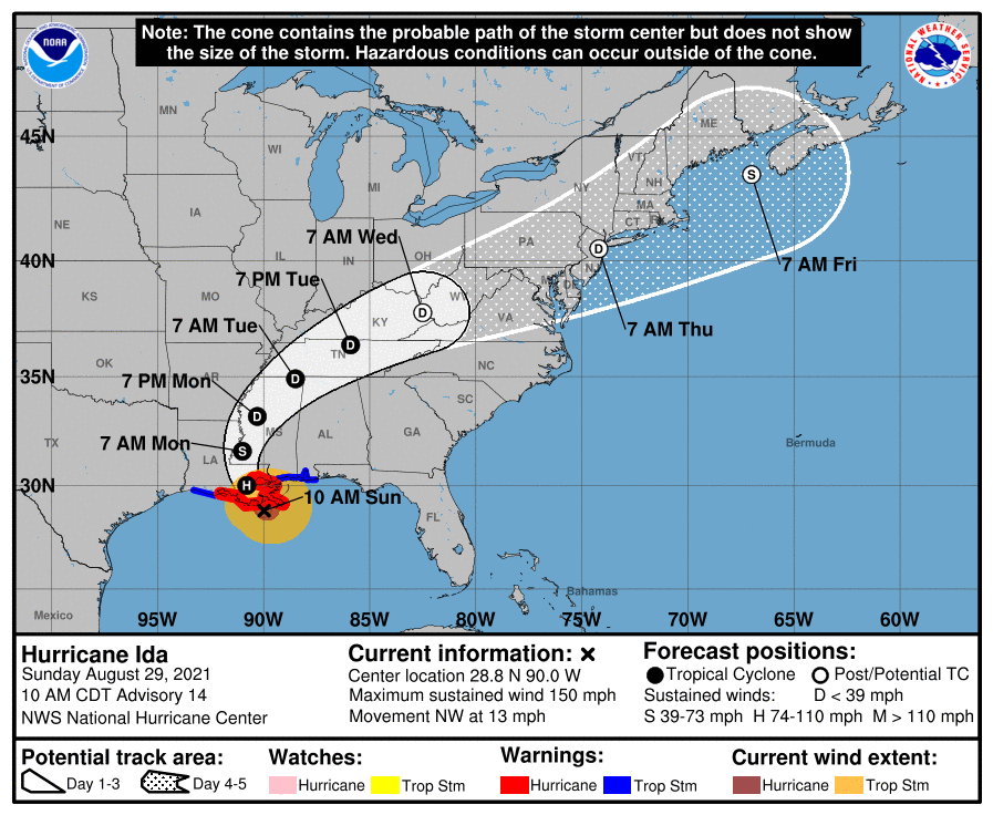
With time, the remnants of this impressive hurricane will spread north and east, impacting areas recently hit hard by massive flooding, such as Tennessee and New Jersey. By tomorrow morning, the storm should exit Louisiana into southwestern Mississippi. From there, Ida is forecast to weaken to a tropical depression and impact northwestern Alabama by Tuesday morning and central Tennessee by Tuesday afternoon. By Wednesday morning, Ida’s center should be near the West Virginia / Kentucky border; by Thursday morning, it should be right on top of the New York City metro area. While Ida will dramatically lose much of its punch today as it moves inland, it will still have the potential to drop copious amounts of rain in its path. This rain will likely lead to widespread flash and river flooding.
