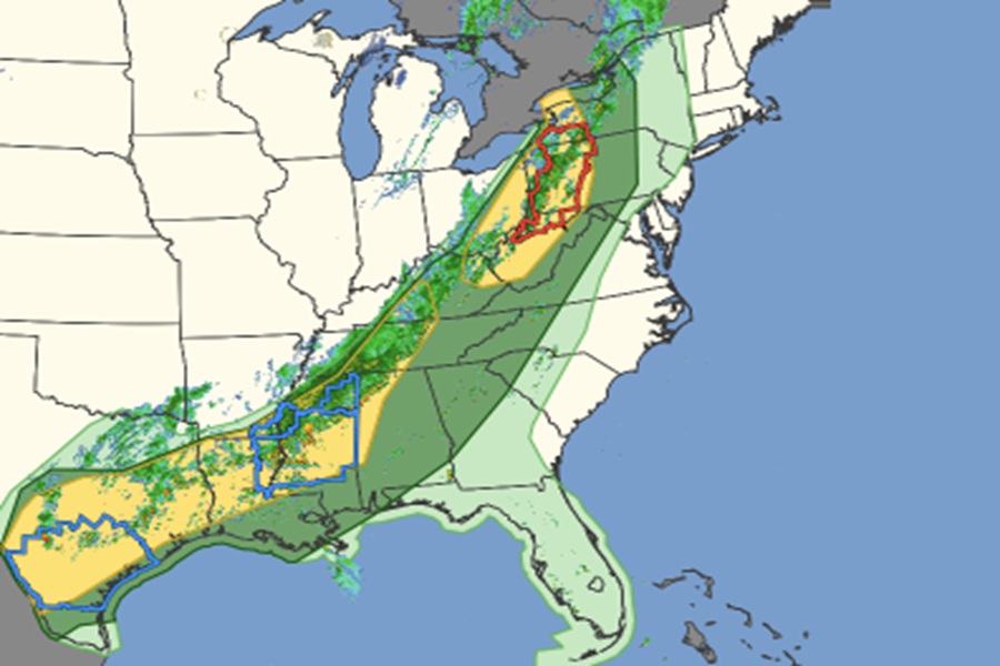
A severe thunderstorm and tornado threat continues to march east today, threatening people from Texas to New York with severe weather. Due to existing hazards, the National Weather Service has issued a Tornado Watch for portions of New York, Pennsylvania, and West Virginia; a Severe Thunderstorm Watch is also in effect for portions of Texas, Louisiana, Arkansas, and Mississippi.
Showers and thunderstorms are tracking eastward along and ahead of an advancing cold front. Increased shear ahead of a leading upper-level shortwave over the Lower Great Lakes and Upper Ohio Valley is expected to lead to a few more robust thunderstorms. Greater instability and sufficient shear to the southwest over portions of the Lower Mississippi Valley and eastern and southern Texas is also expected to produce some severe weather with the threat of large hail and damaging winds. In addition, the tendency for storms to train andrepeat over the same areas as storm movements become more parallel to the increasingly east/west oriented cold front across the Lower Mississippi Valley and Texas could lead to excessive rainfall and the threat of some scattered instances of flash flooding. More isolated instances of severe weather and flash flooding can be expected elsewhere ahead of the
front.
The cold front is expected to continue tracking eastward spreading the convection to the Mid-Atlantic and New England regions for Sunday. The frontal boundary will move offshore while lingering from the Southeast to the south-central states. Unlike today, though, the risk for severe weather and flash flooding on Sunday is currently expected to remain isolated.
