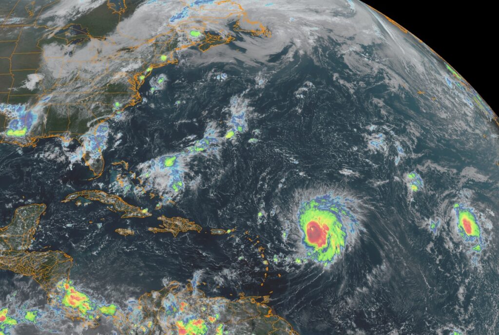
According to the National Hurricane Center in Miami, Florida, major Hurricane Lee is expected to be around a Category 4 or 5 storm for many days as it spins about north of the Leeward Islands and east of the Bahamas. Impacts in the form of rough surf will begin to be felt along the East Coast this weekend, and significant, perhaps direct impacts may be felt across portions of the northeast by the end of next week.
As of the latest advisory from the National Hurricane Center (NHC), Major Hurricane Lee was located about 500 miles east of the Northern Leeward Islands. With maximum sustained winds of 150 mph, Lee is a powerful Category 4 hurricane. It is moving to the west-northwest at 13 mph while having a minimum central pressure of 942 mb or 27.82″.
While Lee is moving toward the west-northwest now at 13 mph, the NHC expects while the motion will continue, the forward speed will significantly drop. On the forecast track, Lee is expected to pass well to the north of the northern Leeward Islands, the Virgin Islands, and Puerto Rico over the weekend and into early next week.
While Lee is a category 4 hurricane on the Saffir-Simpson Hurricane Wind Scale now, it did reach Category 5 status with winds greater than 157 mph before and it could again. Some fluctuations in intensity are likely over the next few days, however Lee is expected to remain a powerful major hurricane through early next week. In fact, the NHC is keeping Lee as a Category 4 or 5 storm for the next several days into Tuesday.
Right now, Lee’s hurricane-force winds extend outward up to 35 miles from the center and tropical-storm-force winds extend outward up to 150 miles. As it moves north and west, Lee’s windfield is expected to expand wider as it becomes an even larger hurricane over time.
Hurricane #Lee is a massive hurricane that’ll continue to grow in intensity and size. And regardless of whether or not it makes landfall on the east coast, the surf will be rather violent up & down the entire coast for many days around it. pic.twitter.com/vitk2Lj1oV
— the Weatherboy (@theWeatherboy) September 7, 2023
Swells generated by Lee are affecting portions of the Lesser Antilles, and will reach the British and U.S. Virgin Islands, Puerto Rico, Hispaniola, the Turks and Caicos Islands, the Bahamas, and Bermuda this weekend. These swells are likely to cause life-threatening surf and rip current conditions. Dangerous surf and rip currents are expected to begin along most of the U.S. East Coast beginning Sunday and Monday and worsen throughout the week. Even expert swimmers and surfers should avoid the ocean until the storm and its hazards pass.
Forecasters at the NHC still aren’t sure where the storm will end up next week, even though more and more model guidance is suggesting a North American landfall at the end of the week. For now, the NHC has this key point to share: “It is way too soon to know what level of impacts, if any, Lee might have along the U.S. East Coast, Atlantic Canada, or Bermuda late next week, particularly since the hurricane is expected to slow down considerably over the southwestern Atlantic. Regardless, dangerous surf and rip currents are expected along most of the U.S. East Coast beginning Sunday and Monday. Continue to monitor updates to Lee’s forecast during the next several days.”