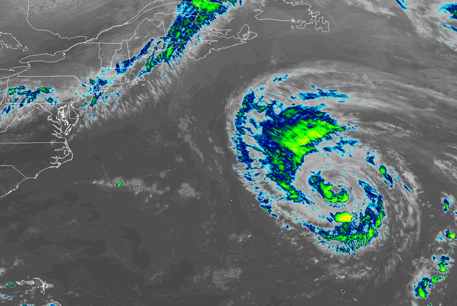
Hurricane Leslie continues to spin about over the open waters of the central Atlantic. The storm has been in the Atlantic for several weeks now. On September 22, a non-tropical area of low pressure formed and transitioned into a Subtropical Storm. At that point, the National Hurricane Center (NHC) named the system Leslie. Leslie has weakened, strengthened, and even merged with a frontal system over time, eventually becoming a potent extratropical cyclone on September 27. The next day, the system took on tropical characteristics. In time, on October 3, Leslie strengthened into a hurricane.
As of the latest advisory today, the center of Hurricane Leslie was located near latitude 32.5 North, longitude 57.2 West. Leslie is moving toward the north
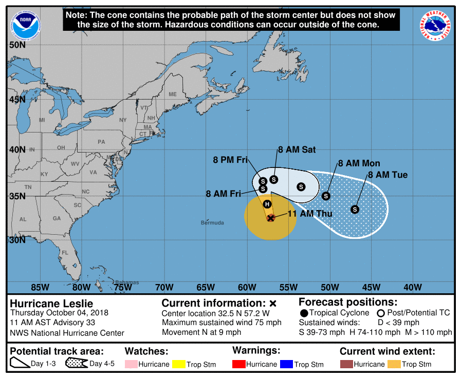
near 9 mph , and this motion with an increase in forward speed is expected through tonight according to the NHC. The NHC is forecasting an additional reduction in speed on Friday and Friday night, with Leslie turning toward the east or east-southeast over the weekend. Maximum sustained winds have decreased to near 75 mph with higher gusts. Continued gradual weakening is expected during the next several days, and Leslie may weaken to a tropical storm by Friday. For now, hurricane-force winds extend outward up to 40 miles from the center and tropical-storm-force winds extend outward up to 195 miles. The estimated minimum central pressure is 979 mb or 28.91 inch.
The official forecast track from the NHC shows the storm continuing to move around over open waters of the Atlantic with no threat to land. However, it is kicking-up surf far from the center; boaters and swimmers anywhere along the US East Coast and Bermuda should be aware of that hazard. Otherwise, no direct impacts to land are expected at this time.
