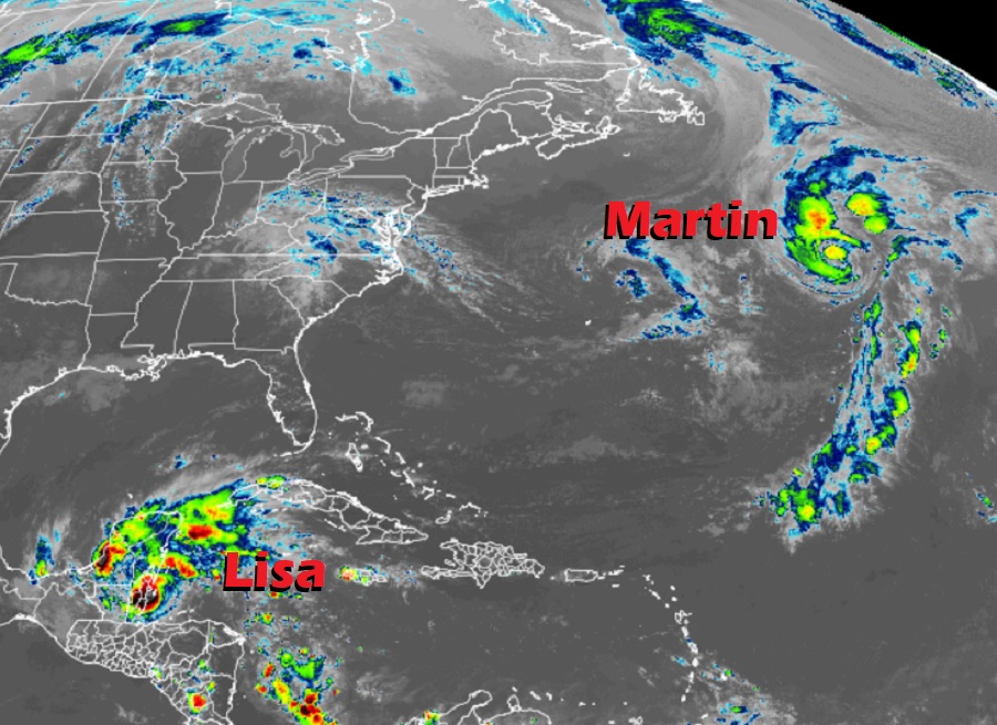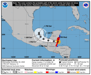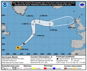
The National Hurricane Center is busy tracking and forecasting two November hurricanes: Hurricane Lisa currently making landfall on Belize, and Hurricane Martin, which is in the open North Atlantic. Lisa is in the process of making landfall near Belize City, where strong winds, storm surge flooding, and heavy rains are lashing portions of Central America. Meanwhile, Martin, the season’s latest hurricane, is posing a threat to trans-oceanic shipping lanes.
This is the first time since 2001 and only the third time on record that there have been two hurricanes at the same time in the Atlantic hurricane basin. With Lisa and Martin here, the 2022 Atlantic season is now considered a near-normal season with 13 named storms and 7 hurricanes (compared to the 1991-2020 average of 13.5 named storms and 6.7 hurricanes.)

Lisa made landfall in Belize as a category 1 hurricane with maximum sustained winds of 85 mph. Lisa is the first landfalling hurricane in Belize in November since 1942.
With Lisa moving on-shore, hurricane conditions are expected along the coast of Belize and the southeastern Yucatan Peninsula during the next few hours. Tropical storm conditions are expected along portions of the coast of Guatemala and over the eastern Yucatan Peninsula too, prompting Tropical Storm Warnings to be issued for those areas. Localized flash flood conditions are expected across portions of Belize, northern Guatemala, and portions of southeastern Mexico.
The National Hurricane Center (NHC) is forecasting that Lisa will re-emerge over water in the southern Gulf of Mexico this weekend; some regeneration is possible and interests elsewhere in Mexico and the U.S. Gulf Coast should closely monitor the storm’s future track.

While Lisa is heading over land, Martin is heading over water and isn’t expected to run into any land for at least the next 5 days. While the hurricane won’t impact land, it will impact important shipping lanes that exist in the central Atlantic that bring cargo from North America to Europe and vice versa.
As of the latest advisory from the NHC, Martin has maximum sustained winds of 85 mph and a minimum central pressure of 974 mb or 28.77″. Martin was moving to the northeast at a swift 31 mph. It is located roughly 1,125 miles west of the Azores and roughly 720 miles south-southeast of Cape Race, Newfoundland.
According to the NHC, Martin should get larger and stronger through tomorrow and then gradually lose strength from Thursday through the weekend. While it will lose its punch, it will still remain a very large cyclone into the weekend.
While the Atlantic Hurricane Season continues through to the end of this month, the NHC isn’t tracking any other tropical cyclone threats in the Atlantic Basin this week.