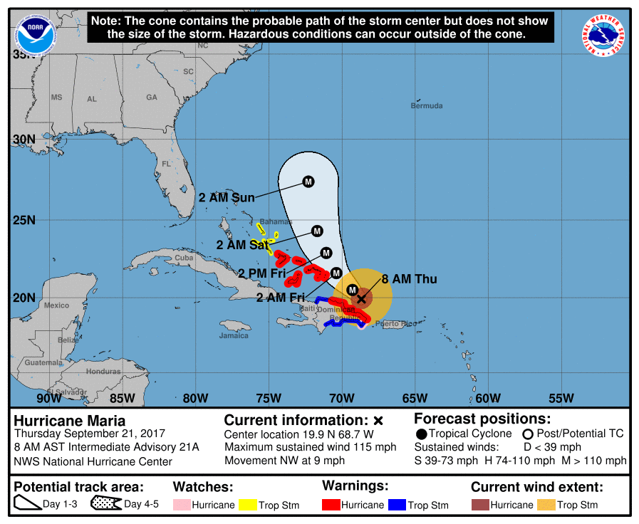
After a catastrophic landfall with Puerto Rico yesterday, Hurricane Maria’s future is less certain. While the powerful storm is moving away from Puerto Rico and headed towards the southeastern Bahamas, where it heads next is up for debate. A complex weather pattern over the United States mainland and Atlantic Ocean, combined with the remnants of what was once Hurricane Jose, have computer models a bit puzzled. And it likely won’t be earlier than Sunday night before meteorologists have a better idea of where Maria will go.
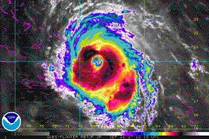
Although the large, 40 mile wide diameter, eye of the hurricane is still a little ragged-looking, the National Hurricane Center (NHC) says it is gradually becoming better defined, and a ring of cold cloud tops is intensifying around the eye. The current intensity estimate is 100 kt based on earlier Air Force Hurricane Hunter data. Maria is likely to move over warm waters with moderate southwesterly vertical shear for the next couple of days. Maria’s well-developed upper-level outflow suggests that shear is probably not having much influence over the hurricane at this time. Although the numerical guidance is not very aggressive about intensification, based on the current trends of the cloud pattern, some strengthening seems likely over the next day or so. Later in the forecast period, shear will probably cause gradual weakening.

Maria’s forecast position for the next 5 days is easier to determine than beyond that five day window. Maria continues its northwestward motion at about 8 kt. The hurricane is expected to turn north-northwestward and northward around a subtropical ridge over the Atlantic for the next 2 to 3 days. Late in the forecast period, a mid-level high over the northeastern US could slow the forward motion somewhat. This high is forecast by the global models to subsequently weaken however, which should allow Maria to turn north-northeastward in the flow on the northwestern edge of a subtropical ridge over the west-central Atlantic. The official track forecast lies between the corrected consensus guidance and the latest ECMWF prediction and is quite similar to the previous NHC track. However, if that ridge strengthens beyond the weekend, it could steer Maria into the Mid Atlantic coast, taking a path similar to what Hurricane Sandy did in 2012. It is too soon to say with certainty where Maria will go and residents along the Mid Atlantic coast should continue to watch the storm and have a Hurricane Action Plan ready in the event the hurricane does come closer to the coast with time.
The NHC has these two key points they want known:
- Heavy rainfall is expected to continue, and catastrophic flash flooding is occurring in Puerto Rico, especially in areas of mountainous terrain. Everyone in Puerto Rico should continue to follow advice from local officials to avoid these life-threatening flooding conditions.
- A Hurricane Warning is in effect for the northern coast of the Dominican Republic, the Turks and Caicos Islands, and the southeastern Bahamas, where Maria is expected to bring dangerous wind, storm surge, and heavy rainfall.