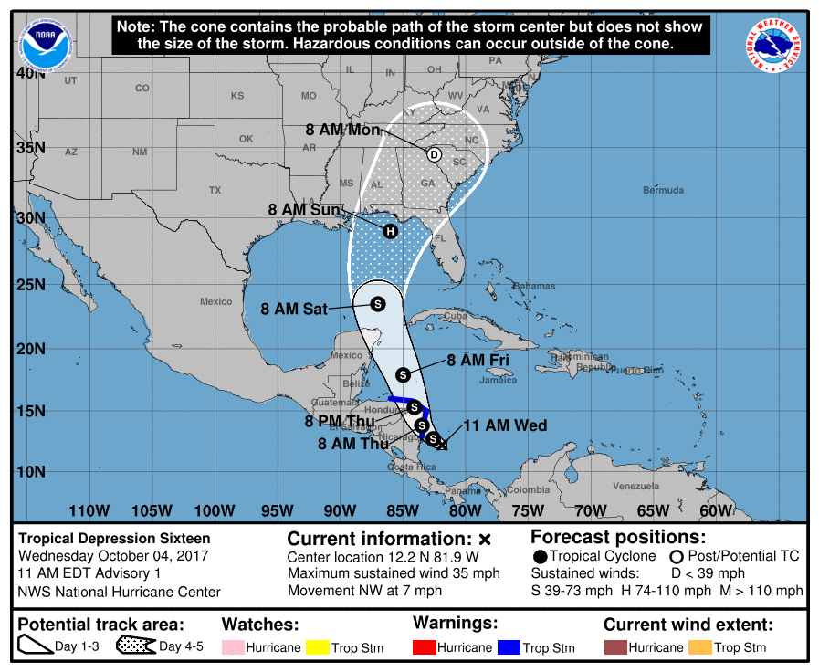
The National Hurricane Center (NHC) has classified an area of disturbed weather in the Caribbean as Tropical Depression #16 and the NHC believes this system will further strengthen to hurricane status and be named Nate, possibly impacting the US Gulf Coast as soon as next weekend.
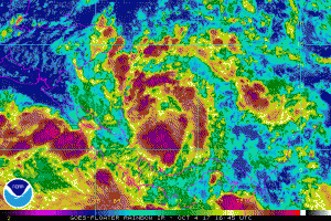
Satellite images indicate that the area of low pressure in the southwestern Caribbean Sea has become better organized since yesterday. Weather satellite GOES-16 one-minute visible data suggests the center is in between two large curved bands of deep convection, not too far from San Andres Island. An Air Force Reserve Hurricane Hunter aircraft should be in the area this afternoon to provide a better estimate of the strength and structure of this storm.

Other than land interaction between the next one to one and a half days, environmental conditions look conducive for intensification of the depression. A large mid/upper-level trough is forecast to drop over the SW Gulf of Mexico, providing a low-shear environment for the cyclone. Rapid intensification is a possibility over the northwestern Caribbean or southern Gulf of Mexico while the system is traversing rather warm and deep waters, although it remains to be seen how separate the depression becomes from a larger gyre over central America. The official intensity forecast from the National Hurricane Center eventually brings this system to hurricane strength by late Saturday night or early Sunday morning.
The depression is moving slowly northwestward this morning, around a distant mid-level ridge over the southwestern Atlantic Ocean. However the steering pattern should change quickly tomorrow as the aforementioned mid-tropospheric trough moves across the northwestern Caribbean into the southwestern Gulf of Mexico. Southerly flow on the eastern side of that trough should cause the cyclone to move much faster to the north-northwest by Friday and northward into the Gulf of Mexico on Saturday. As the trough moves away, a building ridge over the southwestern Atlantic is forecast to steer the system to the north-northeast or northeast toward the northern Gulf
states.
The National Hurricane Center has these two key messages they want shared from the latest advisory update:
- The depression is forecast to strengthen and bring tropical storm conditions and heavy rainfall to portions of Nicaragua and Honduras tonight through Thursday.
- The system is forecast to continue strengthening over the Gulf of Mexico and could affect portions of the northern Gulf Coast as a hurricane this weekend, with direct impacts from wind, storm surge, and heavy rainfall. However, it is too early to specify the timing or magnitude of these impacts. Residents along the Gulf Coast from Louisiana to Florida should monitor the progress of this system for the next several days and heed any advice given by local officials.
With the threat of another landfalling hurricane on the US coast, it is imperative that people along the US Gulf Coast make sure they have a Hurricane Action Plan in place. It may become necessary to act on that plan prior to the weekend.