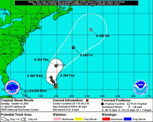
Tropical Storm Nicole is still spinning about in the Atlantic today, but it is forecast by the National Hurricane Center to grow back into a full-fledged hurricane and landfall on Bermuda as soon as Thursday.
As of the latest advisory from the National Hurricane Center, they describe Nicole as a system moving along the southwestern periphery of a mid-level ridge to its northeast. While this general motion should continue today, a
shortwave trough trekking across Atlantic Canada is expected to bypass Nicole during the next 24 hours, and allow a weak mid-level ridge to build north and west of the cyclone during the next day or two. This synoptic pattern should result in a leftward bend of the track through about 48 hours. After that time, global computer forecast models show Nicole turning northward and then northeastward with an increase in forward speed once it reaches a faster-paced westerly
flow around 30N.
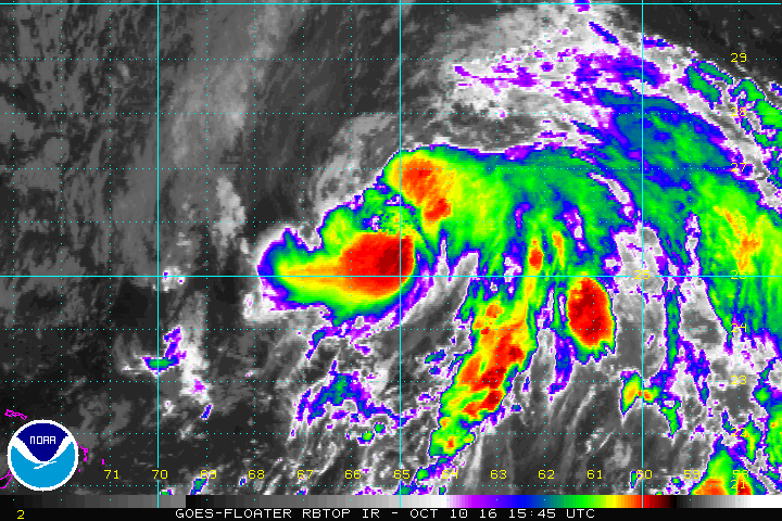
During the last 24 hours, a piece of vorticity that fractured from a central Atlantic shortwave trough has been merging with Nicole. The interaction of this feature with Nicole and a continuation of strong northerly shear could explain the degraded satellite appearance of Nicole since yesterday. Nonetheless, the shear is still forecast to diminish during the next day or two, as the cyclone traverses near-record warm sea surface temperatures, finds itself in a reasonably moist environment and an increasingly diffluent flow aloft. These factors suggest that a significant re intensification is still possible, as the global models continue to show. The only caveat would be to what degree a drier and more stable air in the wake of Post-Tropical Matthew would modify as it is at least partially ingested by Nicole’s circulation. Some model output shows the shear greatly increasing by 96 hours, which would likely result in an end to the predicted intensification phase unless baroclinic processes become dominant and result in just a little bit more. The new intensity forecast is similar to the previous one and is close to the multi-model consensus. It should be noted that global models show Nicole becoming a large hurricane in about 3 days, with a wide distribution of strong winds over the central Atlantic.
With Bermuda in the potential path of this storm, residents and visitors there should make sure they have a Hurricane Action Plan; it may become necessary to act on that plan should the storm strengthen and head to the island in the coming days.
You can see more details about Nicole and any other tropical cyclone around US waters in the Pacific and Atlantic on our Hurricanes & Tropical Weather page here: https://weatherboy.com/hurricanes-tropical-weather/
