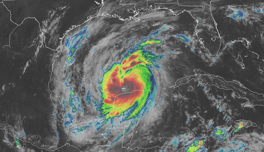
Hurricane Delta is entering the central Gulf of Mexico, where it is forecast to strengthen from the 100 mph storm it is now into a category 3 major hurricane soon. With impacts to the U.S. coast likely, the National Hurricane Center has issued Hurricane Watches and Storm Surge Watches for a portion of the Gulf Coast likely to see Delta’s wrath at the end of the week.
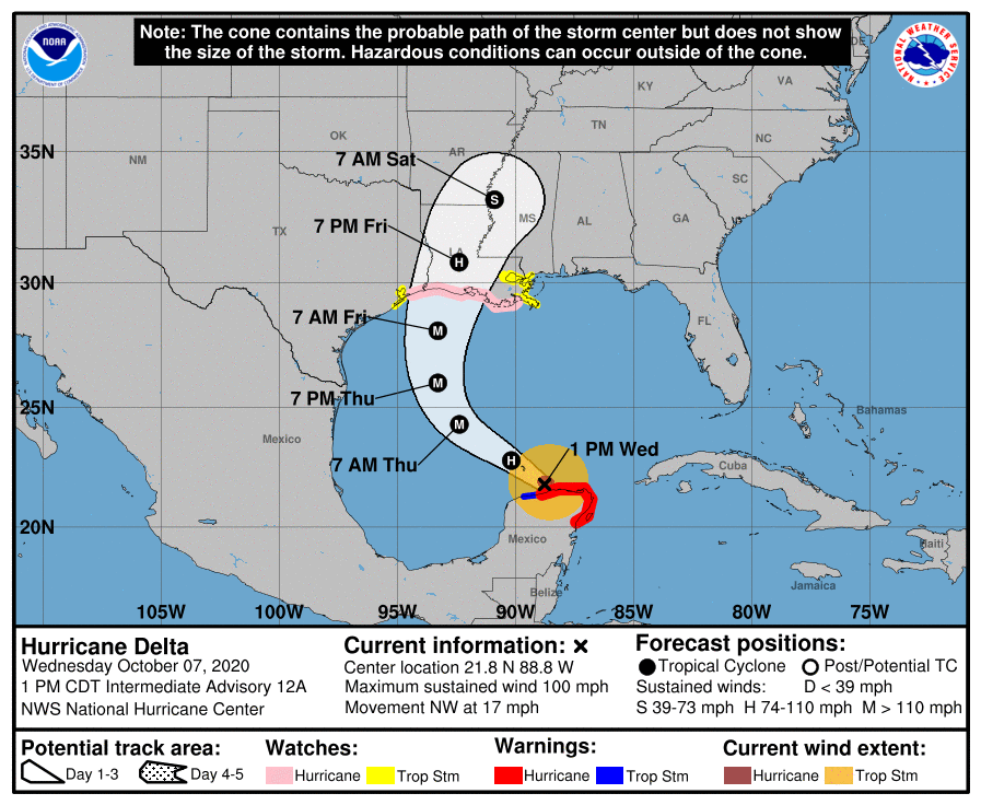
Currently, Delta is located at 21.8N 88.8W which is roughly 115 miles west of Cabo Catoche, Mexico and about 65 miles east-northeast of Progreso, Mexico. The hurricane is moving to the northwest at 17 mph; its minimum central pressure is at 975 mb or 28.80 inches.
A Storm Surge Watch is now in effect from High Island, Texas, to the Alabama/Florida border including Calcasieu Lake, Vermilion Bay, Lake Pontchartrain, Lake Maurepas, Lake Borgne and Mobile Bay. A Hurricane Watch is also in effect from High Island, Texas to Grand Isle, Louisiana. A Tropical Storm Watch has also been issued for the area from San Luis Pass to west of High Island Texas and for the area east of Grand Isle Louisiana to Bay St. Louis, Mississippi, including the city of New Orleans. A Tropical Storm Watch is also up for Lake Pontchartrain and Lake Maurepas.

Each watch means something different. A Storm Surge Watch means there is a possibility of life-threatening inundation, from rising water moving inland from the coastline, in the indicated locations during the next 48 hours. A Hurricane Watch means that hurricane conditions are possible within the watch area. A watch is typically issued 48 hours before the anticipated first occurrence of tropical-storm-force winds, conditions that make outside preparations difficult or dangerous. A Tropical Storm Watch means that tropical storm conditions are possible within the watch area, generally within 48 hours.
Delta is expected to strike the U.S. coast line at the end of the week. For now, Delta is moving toward the northwest near 17 mph; a northwestward motion with a reduction in forward speed is expected over the next 24 hours. According to the National Hurricane Center, a north-northwestward motion is expected by late Thursday, and a faster northward to north-northeastward motion is forecast on Friday and Friday night. On the forecast track, the center of Delta will move over the southern Gulf of Mexico this afternoon, be over the southern or central Gulf of Mexico through Thursday, and approach the northern Gulf coast within the hurricane watch area on Friday.
While maximum sustained winds are near 100 mph now, the National Hurricane Center is forecasting re-strengthening as the hurricane moves over
the southern and central Gulf of Mexico through Thursday, and Delta is expected to become a major hurricane again. Some weakening is forecast as Delta approaches the northern Gulf coast on Friday.

Delta will bring many dangerous conditions to the Gulf Coast at and after landfall including a serious storm surge, flooding rains, damaging winds, and rough surf.
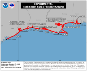
A life-threatening storm surge will raise water levels in areas of onshore winds by as much as 7-11′ above normal tide levels along portions of the Gulf Coast. The combination of a dangerous storm surge and the tide will cause normally dry areas near the coast to be flooded by rising waters moving inland from the shoreline. The deepest water will occur along the immediate coast near and to the east of the landfall location, where the surge will be accompanied by large and dangerous waves. Surge-related flooding depends on the relative timing of the surge and the tidal cycle, and can vary greatly over short distances.
Tropical storm force wind conditions are possible within the watch
areas along the Gulf coast by late Thursday night or early Friday with hurricane conditions possible within the hurricane watch area by Friday morning.
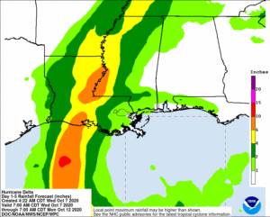
From Friday through Saturday, Delta is expected to produce 4-8″ of rain, with isolated maximum totals of 12″ across portions of the central Gulf Coast north into portions of the Lower to Middle Mississippi Valley. These rainfall amounts will lead to flash, urban, small stream, and minor river flooding. As Delta moves farther inland, 1-3″ of rain, with locally higher amounts is expected in the Ohio Valley and Mid Atlantic this weekend.

The Gulf of Mexico will continue to be rough for many days. Swells generated by Delta will affect land areas around the northwestern Caribbean Sea today. Swells will begin to affect portions of the northern and western Gulf coast on Thursday. These swells are likely to cause life-threatening surf and rip current conditions. Even experienced swimmers and surfers should avoid coastal waters until the threats from Delta have disappeared.