
A complex weather pattern will be setting-up in the coming days, helping grow Tropical Storm Willa into a major hurricane; over time, Willa’s remnants could help fuel a significant nor’easter. Willa became a tropical storm earlier today, the latest in a long line of storms that have formed in the Eastern Pacific Hurricane Basin. Over time, Wilma is forecast to create trouble across a large area of North America.
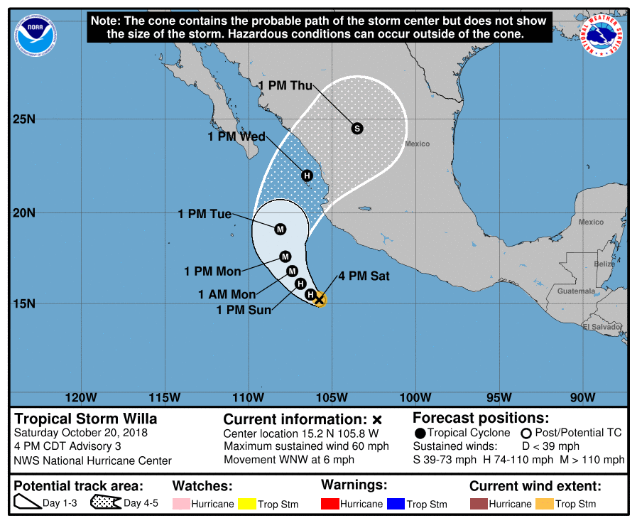
Tropical Storm Willa is expected to rapidly intensify to hurricane strength tonight and rapidly intensify further to major hurricane strength by tomorrow night. As of the latest advisory from the National Hurricane Center, the center of Tropical Storm Willa was located near latitude 15.2 North, longitude 105.8 West. Willa is moving toward the west-northwest near 6 mph and a turn toward the northwest and north at a slightly slower forward speed is expected through Tuesday. Willa could approach the coast of west central mainland Mexico by Wednesday as it begins to accelerate toward the northeast. Maximum sustained winds are at 60mph now but should be near 110 mph tomorrow night this time. Tropical-storm-force winds extend outward up to 35 miles from the center. The estimated minimum central pressure is 999 mb or 29.50 inches.
With Willa used, the basin is running out of storm names for a season that runs through to the end of November. This is one of the busiest seasons on record; the Northeast Pacific Basin also used a “W” name in 1983 (Winnie), 1985 (Waldo), and 1992 (Winifred). In 1992, the basin got up to the Z storm (Zeke), but had no more. Facing the prospect of running out of names, the National Hurricane Center has decided to use letters from the Greek alphabet to name storms should the list be exhausted, beginning with Tropical Storm Alpha. The basin has three storms to get through before that would happen: Xavier, Yolanda, and Zeke.
The official forecast track for Willa brings it into the central Mexico coast by the early to middle part of next week, weakening it as it does so. While the impacts will linger over Mexico for several days, bringing life-threatening flash flood conditions there, a large surge of moisture associated with Willa will travel into Texas and the Gulf coast.
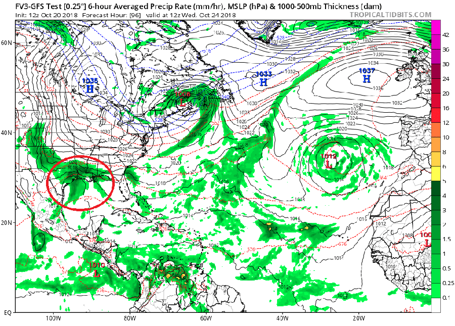
Along the Gulf coast, a significant area of low pressure is expected to form. Unlikely to become a tropical cyclone, this system will bring wind-swept rains to areas recently hit hard by Major Hurricane Michael. This storm system will intensify as it heads north and east near the U.S. East Coast.
How close this storm tracks to the U.S. East Coast will determine what kind of impacts will be felt in the northeast. Should the system track just off the coast, damaging winds and heavy rain would be likely for much of the Mid Atlantic and southeastern New England. Such a track would also wrap-in cold air, making snow, heavy at times, possible over northern and central New England in the days ahead of Halloween. If the storm phases with a low swinging through the Great Lakes, the impacts would be broader and colder, possibly creating snow over a wider area. Should the storm system remain far off-shore rather than hug the coast, though, impacts will be minimal; while rough surf and breezy conditions would exist, most precipitation would remain off-shore. Should the storm ride up the eastern U.S. and head into the Great Lakes, mild air would surge all the way north to the Canadian maritimes. It would be windy and wet, with no widespread snow expected.
Of the four possible storm track scenarios (hugging the coast, phasing with a Great Lake storm, heading out to sea, or racing to the Great Lakes), the least likely is the last; high pressure should keep the storm closer to the coast or off-shore. The mostly likely is somewhere between a coastal hugger and an off-shore solution; such a track would bring some impacts to the northeast, but damaging conditions likely wouldn’t be one of them.
How the storm system evolves next week as a possible nor’easter will be directly tied to what happens with Willa as it heads into Mexico. As Willa’s forecast is refined this weekend, more clarity will come into view for how its remnant moisture will head east into the United States and perhaps impact the northeast next weekend.
