The National Hurricane Center (NHC) in Miami, Florida has upgraded a tropical depression that formed earlier today to Tropical Storm Ian, the 9th named storm of the 2022 Atlantic Hurricane Season. The National Hurricane Center expects this storm to intensify significantly in the coming days, becoming a major hurricane with maximum sustained winds in excess of 111 mph by the time it strikes the U.S. coast sometime during the middle of next week.
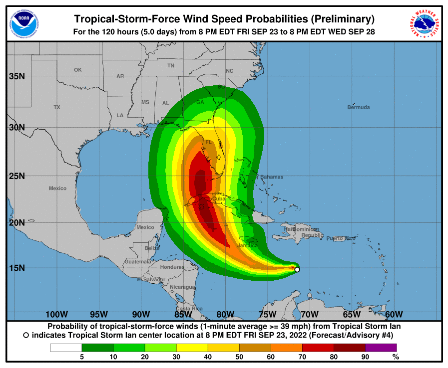
Right now, Ian is located about 385 miles southeast of Kingston, Jamaica and about 680 miles east-southeast of Grand Cayman. Maximum sustained winds inside the tropical storm are 40 mph while the minimum central pressure is 1005 mb or 29.68″. Ian is moving to the west-northwest at 12 mph.
Even before Ian was classified as a Tropical Storm, authorities in the Cayman Island issued a Hurricane Watch across all of their islands; Jamaica also issued a Tropical Storm Watch island-wide. A Hurricane Watch means that hurricane conditions are possible within the watch area. A watch is typically issued 48 hours before the anticipated first occurrence of tropical-storm-force winds, conditions that make outside preparations difficult or dangerous. A Tropical Storm Watch means that tropical storm conditions are possible within the watch area, generally within 48 hours.
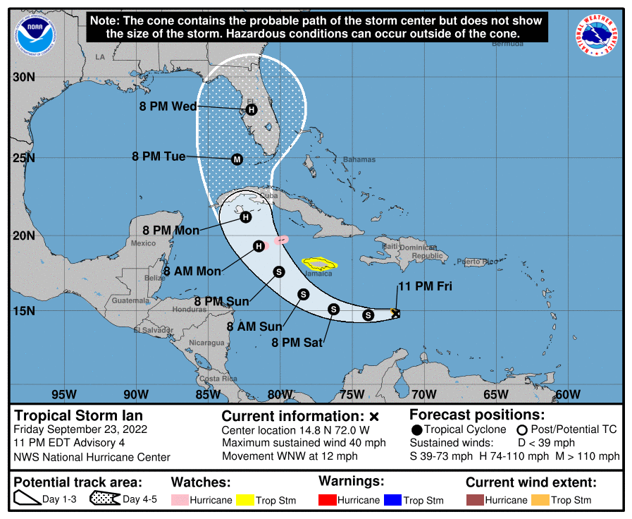
According to the NHC, A westward or west-northwestward motion is expected through early Sunday. A turn toward the northwest is forecast late Sunday, followed by a north-northwestward turn by late Monday. On the forecast track, the center of Ian is forecast to move across the central Caribbean Sea through Saturday, pass southwest of Jamaica on Sunday, and pass near or over the Cayman Islands Sunday night and early Monday. Ian will then approach western Cuba on Monday.
As Ian chugs along, strengthening is forecast during the next few days, and Ian is expected to become a hurricane Sunday night.
Once the storm passes Cuba, it is expected to intensify further in the southeastern Gulf of Mexico into a major hurricane. From there, the NHC forecast has it landfalling somewhere near the central Gulf Coast of Florida sometime later Tuesday or Wednesday. By Wednesday evening, the center of the hurricane is currently forecast to be near the theme park area outside of Orlando, Florida.
The American GFS and European ECMWF computer forecast models both agree that a landfall in Florida is likely, but they differ on precise location and timing. In different ways, both models bring heavy rain and damaging winds up the eastern United States after a Florida impact. It is too soon to know where exactly Ian will strike Florida as well as where exactly it’ll go there from landfall.
