Ida is now a hurricane according to the National Hurricane Service, with additional intensification forecast over the next 48 hours before a catastrophic rendezvous with the central Gulf of Mexico coastline. Ida is now the fourth hurricane of the 2021 Atlantic Hurricane Season to date. Only six other years in satellite era (1966 and beyond) have had 4+ hurricanes by August 27: 1966, 1995, 1996, 2004, 2005 and 2020.
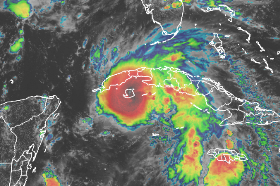
Data from an Air Force Reserve hurricane hunter aircraft indicate that Ida has strengthened into a hurricane as it approaches the Isle of Youth, Cuba. The maximum sustained winds are estimated to be 75 mph with higher gusts, making it a Category 1 hurricane on the Saffir-Simpson wind scale. A sustained wind of 44 mph and a gust of 60 mph were recently reported on Cayo Largo, Cuba.
In the latest update from the National Hurricane Center, Hurricane Ida was located roughly 30 miles east-southeast of Isle of Youth and about 165 miles east of the western tip of Cuba. The hurricane is moving northwest at 15 mph. On the forecast track from the National Hurricane Center (NHC) in Miami, Florida, Hurricane Ida will move over the southeastern and central Gulf of Mexico tonight and Saturday. On Sunday, Ida is forecast to make landfall along the U.S. northern Gulf coast as a major hurricane.
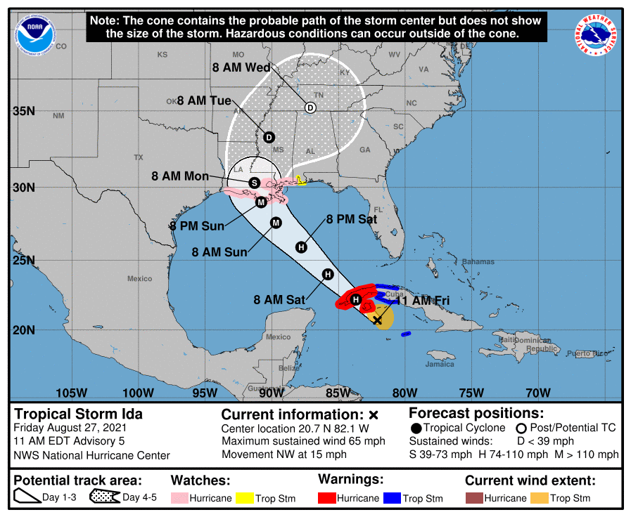
Steady to rapid strengthening is expected when Ida moves over the southeastern and central Gulf of Mexico over the weekend, and Ida is expected to be a major hurricane when it approaches the northern Gulf coast. At this time, it appears likely that Ida will strike Louisiana at the same or greater strength than Hurricane Katrina when it also impacted the state in 2005. And it could be substantially stronger; some forecast guidance suggests that Ida could be a category four hurricane at landfall, which would be catastrophic for the landfall strike zone.
With a hurricane impact just days away, a variety of watches have been posted. A Storm Surge Watch is in effect for the area from Sabine Pass to the Alabama/Florida border as well as for Vermilion Bay, Lake Borgne, Lake Pontchartrain, Lake Maurepas, and Mobile Bay. A Hurricane Watch is in effect for the area stretching from Cameron, Louisiana to the Mississippi/Alabama border; included in the Hurricane Watch are Lake Pontchartrain, Lake Maurepas, and the entire Metropolitan New Orleans area. A Storm Surge Watch means there is a possibility of life-threatening inundation, from rising water moving inland from the coastline, in the indicated locations during the next 48 hours. A Hurricane Watch means that hurricane conditions are possible within the watch area. A watch is typically issued 48 hours before the anticipated first occurrence of tropical-storm-force winds, conditions that make outside preparations difficult or dangerous.
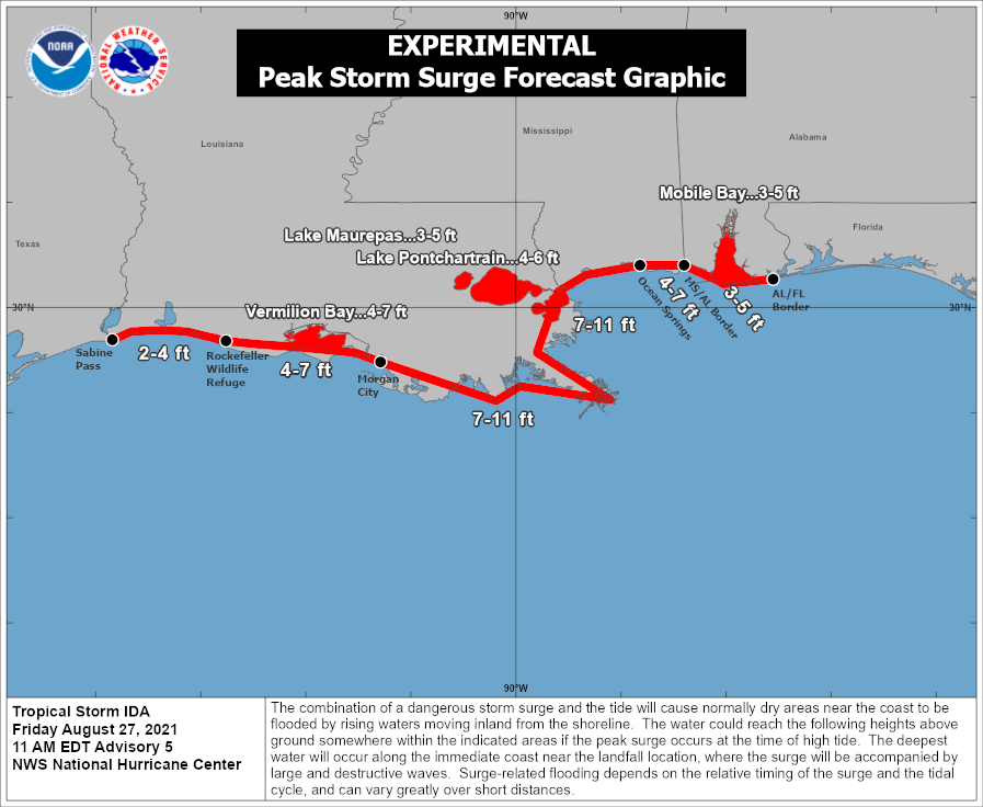
A significant, potentially catastrophic storm surge is expected when Hurricane Ida slams into the Gulf coast. The storm surge could reach 7-11 feet high, flooding coastal communities and topping levees in the area, especially if Ida arrives at high tide. The deepest water will occur along the immediate coast near the landfall location, where the surge will be accompanies by large and destructive waves.
